Severe Thunderstorm Warning for Southern Shelby County Until 5:45 PM
The National Weather Service in Birmingham has issued a severe thunderstorm warning for southern Shelby County until 5:45 PM.
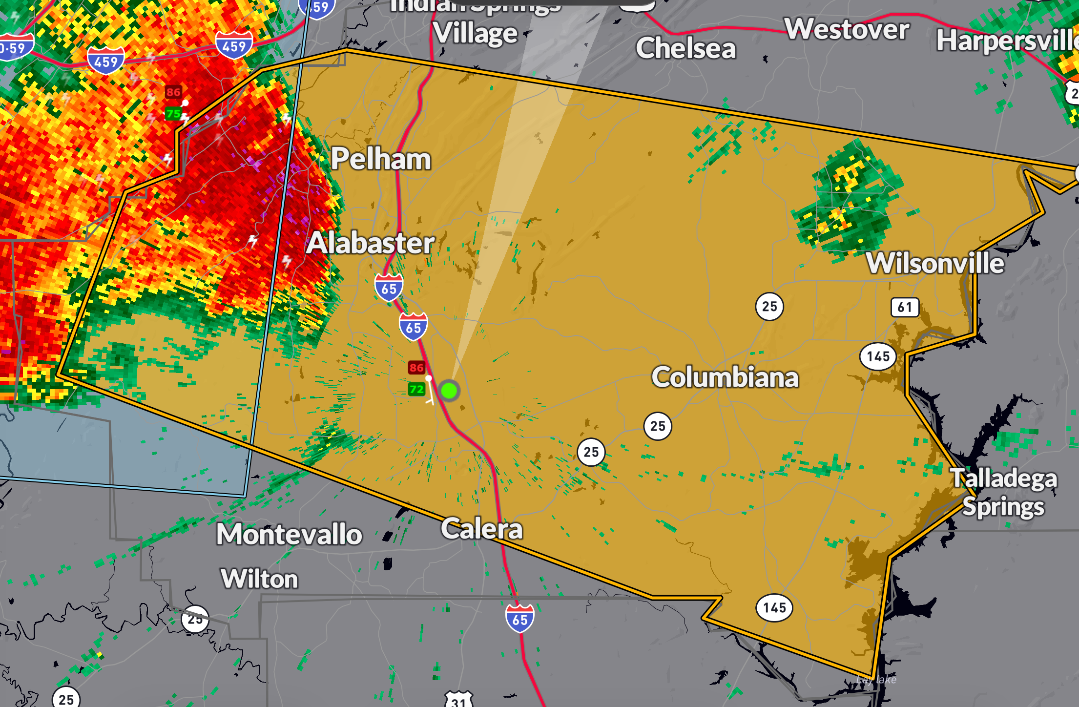
At 4:48 PM, radar indicated a severe thunderstorm over Helena, moving east at 25 mph.
This storm is capable of producing wind gusts up to 60 mph.
The strongest part of the storm is approaching US-31 and I-65 between Valleydale Road and Alabaster. There is a higher chance of damaging wind gusts than with most of today’s storms.
Damage to roofs, siding, and trees is possible.
Locations in the path include Hoover, Alabaster, Pelham, Calera, Montevallo, Columbiana, and Wilsonville.
Also included are Oak Mountain State Park, Lay Lake, and Shelby County Airport.
Seek shelter now in an interior room on the lowest floor of a sturdy building.
Category: Alabama's Weather, ALL POSTS, Severe Weather, Social Media
About the Author (Author Profile)
Bill Murray is the President of The Weather Factory. He is the site's official weather historian and a weekend forecaster. He also anchors the site's severe weather coverage. Bill Murray is the proud holder of National Weather Association Digital Seal #0001 @wxhistorianSubscribe
If you enjoyed this article, subscribe to receive more just like it.


