Severe Thunderstorm Warning for Jefferson, Shelby, and St. Clair Counties Until 4:15 PM
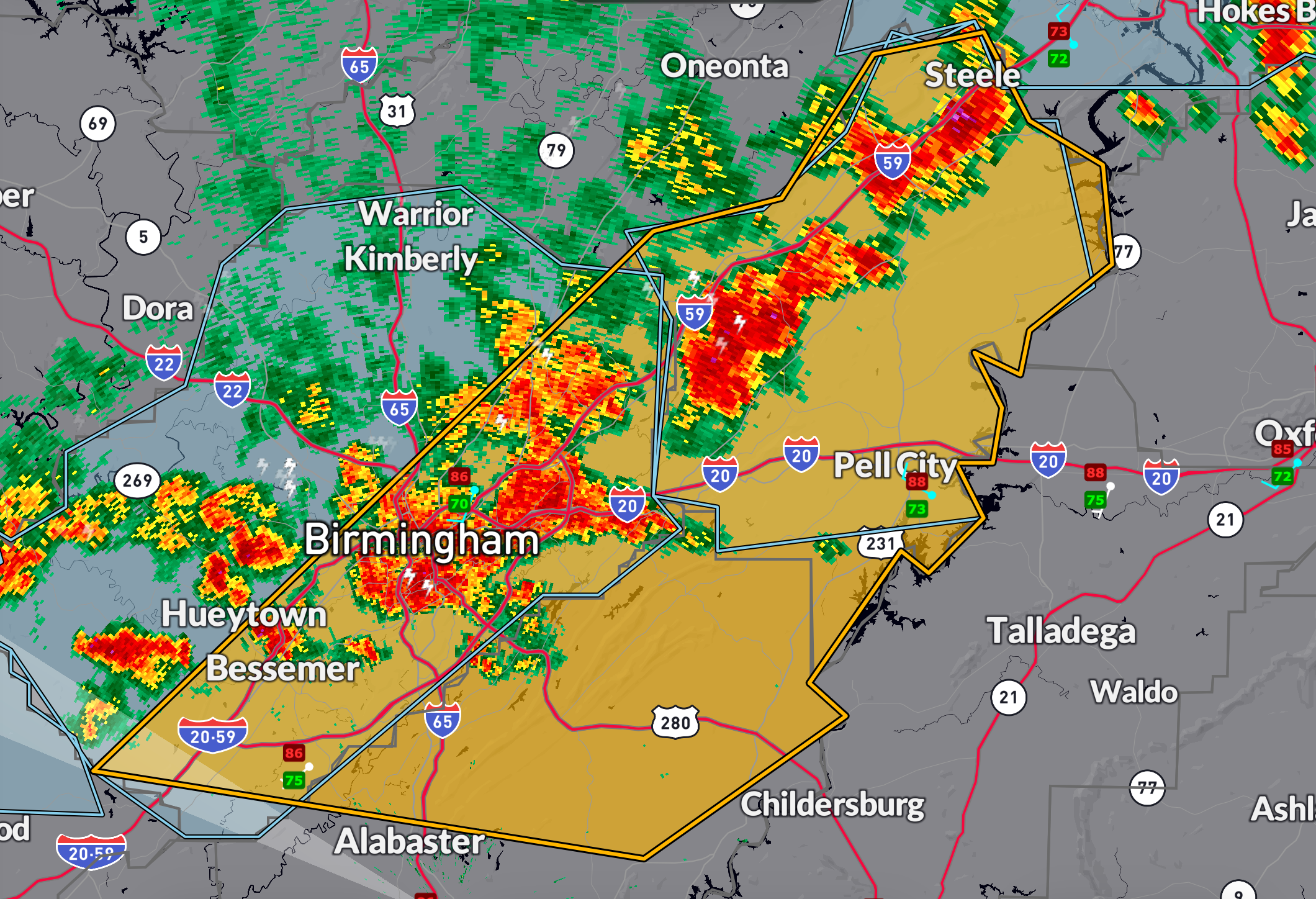
The National Weather Service in Birmingham has issued a severe thunderstorm warning for northern Shelby, southeastern Jefferson, and St. Clair counties until 4:15 PM.
At 3:15 PM, radar indicated severe thunderstorms along a line from near Springville to near Bessemer, moving east at 45 mph.
These storms may produce wind gusts up to 60 mph and hail up to the size of quarters.
Hail damage to vehicles is expected.
Wind damage to roofs, siding, and trees is also possible.
Cities in the path include Birmingham, Hoover, Vestavia Hills, Trussville, Pelham, Moody, Chelsea, and Pell City.
Take cover now in a sturdy structure, away from windows, until the storm passes.
Category: Alabama's Weather, ALL POSTS, Severe Weather, Social Media
About the Author (Author Profile)
Bill Murray is the President of The Weather Factory. He is the site's official weather historian and a weekend forecaster. He also anchors the site's severe weather coverage. Bill Murray is the proud holder of National Weather Association Digital Seal #0001 @wxhistorianSubscribe
If you enjoyed this article, subscribe to receive more just like it.


