Strong Storms in the I-59 Corridor This Afternoon
Strong storms are dropping east southeastward through parts of DeKalb, Etowah, Blount, Jefferson and northern Tuscaloosa counties this afternoon.
They are also dropping into Cherokee County where the NWS Birmingham has just issued a severe thunderstorm warning.
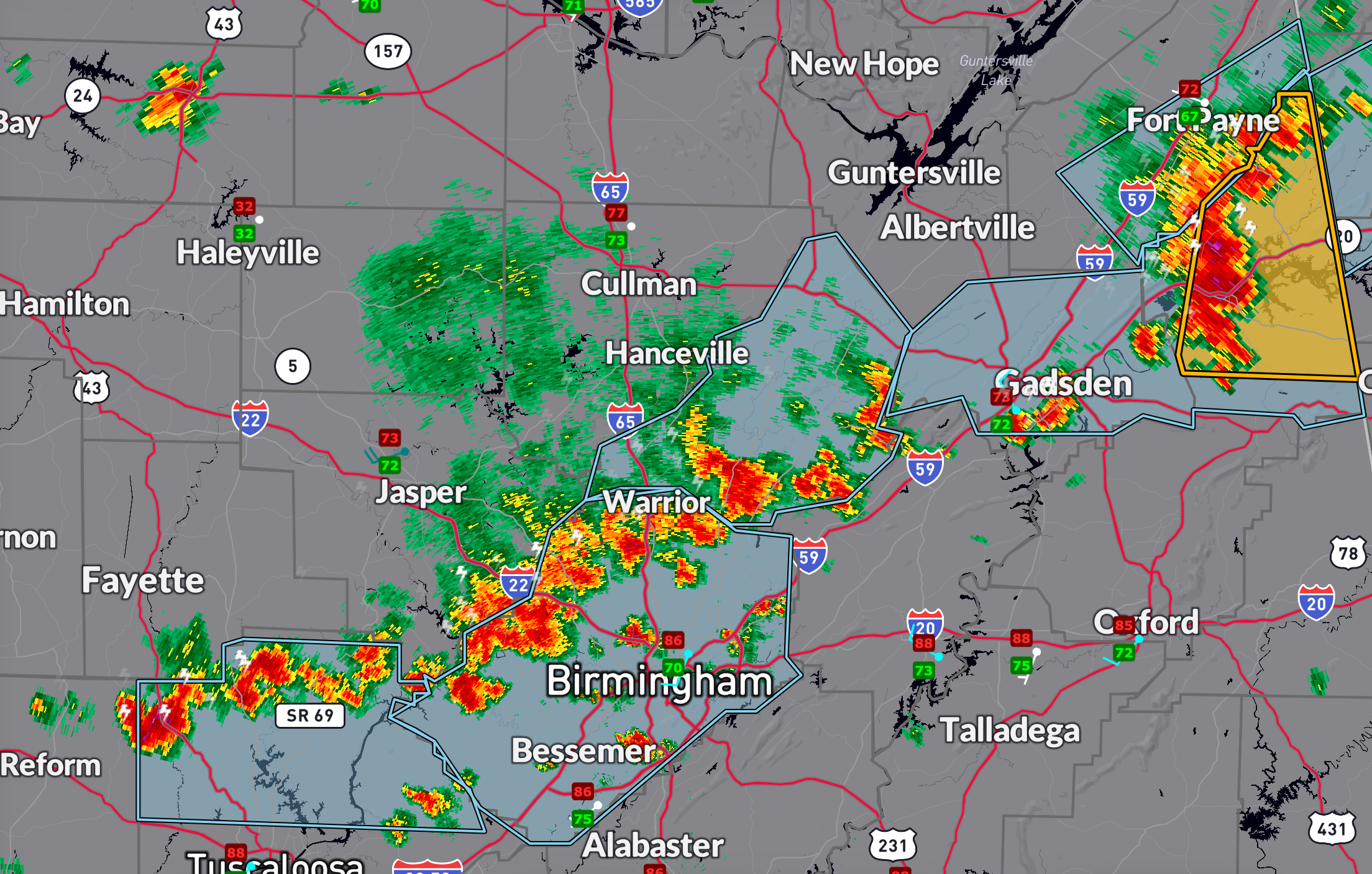
Over the next hour, the storms will reach northern parts of the City of Birmingham and start moving over I-59 between Springville and Gadsden. The Chrokee County storm will move into Northwest Georgia.
All storms today are capable of deadly lightning and gusty winds and well as very heavy rain. But the strongest storms could produce damaging downburst winds.
Category: Alabama's Weather, ALL POSTS, Social Media, Spacey Stuff
About the Author (Author Profile)
Bill Murray is the President of The Weather Factory. He is the site's official weather historian and a weekend forecaster. He also anchors the site's severe weather coverage. Bill Murray is the proud holder of National Weather Association Digital Seal #0001 @wxhistorianSubscribe
If you enjoyed this article, subscribe to receive more just like it.


