Midday Nowcast: Heat Advisory; Big HEAT, Big STORMS
Another stellar day here in Boise, no humidity, blue sky, and a morning low in the low 50s. Highs this afternoon are in the upper 80s, but again with no humidity it feels great…I am loving it!
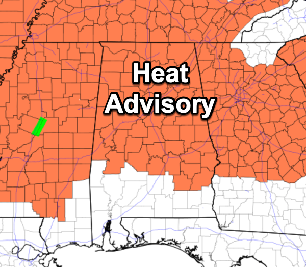
HOT, HOT, HOT: Dangerous heat levels are the story back in Alabama with hot temperatures and high humidity are causing those feels like temperatures to surge above 105°, which is the danger range for North and Central Alabama. A heat advisory has been issued for much of the state today and the next several days. The rest of the weather story is a mix of sun and clouds each day, highs in the mid 90s for many locations, while those heat index values will be in the low 100s. Storms will be fairly scattered and will occur mainly during the peak heating of the day, 2PM-10PM.
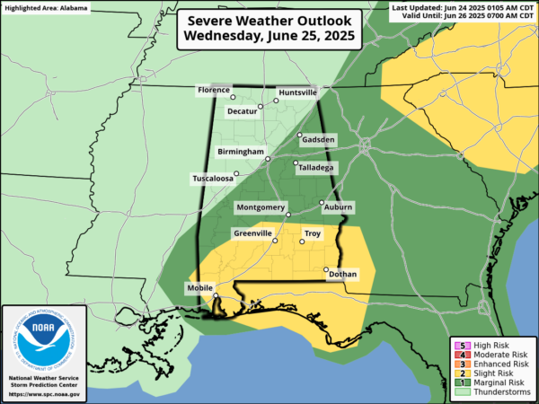
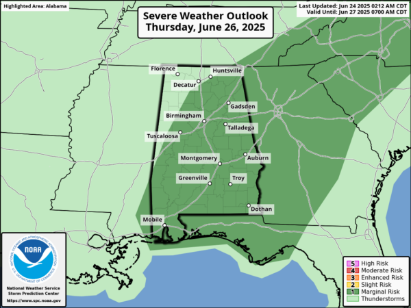
Big HEAT, Big STORMS, and we note the Storm Prediction Center has much of Alabama in a severe weather risk both tomorrow and Thursday. Where afternoon storms do form they will be heavy with potential for strong, gusty winds and small hail.
BIRMINGHAM ALMANAC: For June 24th, the average high for Birmingham is 89° and the average low is 70°. The record high is 99° set in 2024, while the record low is 54° set in 1972. We average 0.15” of precipitation on this date and the record value is 2.28” set in 1997.
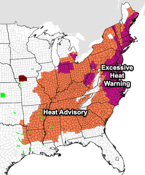
ACROSS THE USA: Extremely dangerous heat will persist from the Midwest to the East Coast into late this week. Monsoonal moisture may produce excessive rain and considerable flash flooding and debris flows, especially near recent burn scar areas in New Mexico and west Texas. Severe storms are possible from the southern/central Plains into the Great Lakes and Northeast, and the northern/central Plains today.
FRIDAY AND THE WEEKEND: The strong upper ridge will weaken and this opens for door for an increase in the number of afternoon/evening showers and thunderstorms, and lower heat levels. Highs drop into the 88-93 degree range with a mix of sun and clouds daily. Chance of any one location seeing rain each day rises to 40-50% percent range.
NEXT WEEK: Temperatures could be a little below average next week with highs in the upper 80s in many areas, otherwise pretty routine summer weather is the story with partly sunny days along with afternoon and evening showers and thunderstorms
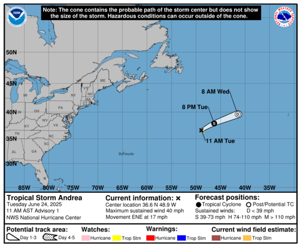
IN THE TROPICS: We have our first named system of the Atlantic hurricane season. At 1100 AM AST, the center of Tropical Storm Andrea was located near latitude 36.6 North, longitude 48.9 West. Andrea is moving toward the east-northeast near 17 mph, and this motion is expected to continue for the next day or so. Maximum sustained winds are near 40 mph with higher gusts. Little change in strength is expected today. Weakening is expected to begin tonight, with Andrea dissipating by Wednesday night. Tropical-storm-force winds extend outward up to 45 miles from the center. The estimated minimum central pressure is 1014 mb (29.95 inches). The rest of the Atlantic is quiet.
WORLD TEMPERATURE EXTREMES: Over the last 24 hours, the highest observation outside the U.S. was 120.0F at Adam Airport, Oman. The lowest observation was -90.6F at Concordia, Antarctica.
CONTIGUOUS TEMPERATURE EXTREMES: Over the last 24 hours, the highest observation was 106F at Death Valley, CA. The lowest observation was 17F at Mackay, ID.
Category: Alabama's Weather, ALL POSTS, Social Media
About the Author (Author Profile)
Macon, Georgia Television Chief Meteorologist, Birmingham native, and long time Contributor on AlabamaWX. Stormchaser. I did not choose Weather, it chose Me. College Football Fanatic. @Ryan_StinnetSubscribe
If you enjoyed this article, subscribe to receive more just like it.


