Strong Storms Moving Into Dallas, Lowndes, and Montgomery Counties
A Severe Thunderstorm Warning is in effect for Dallas, Lowndes, and Montgomery counties until 10:15 PM CDT.
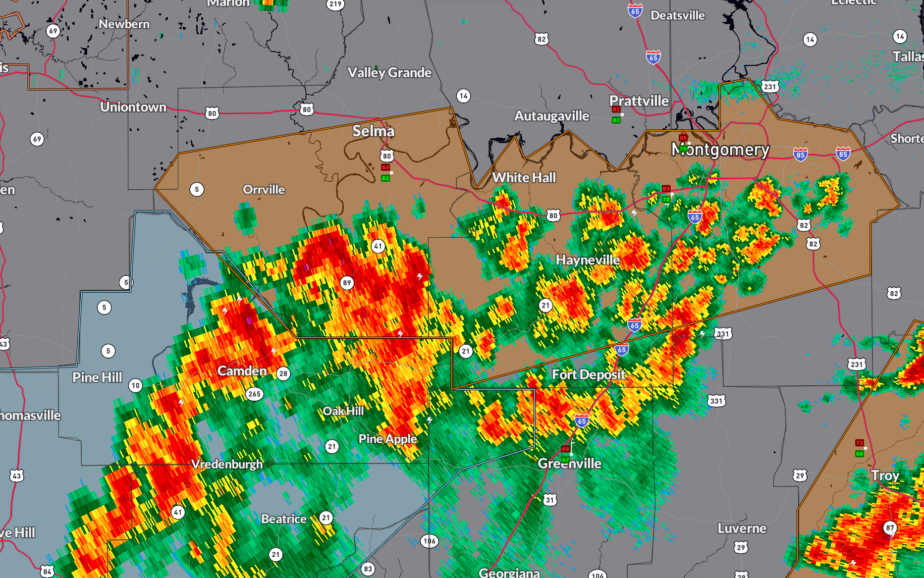
At 9:20 PM, radar showed a line of severe thunderstorms stretching from Pike Road to southeast of Dannelly Reservoir, moving northwest at 25 mph. These storms are producing wind gusts up to 60 mph, capable of damaging roofs, siding, and trees.
Communities in the path include Montgomery, Selma, Hayneville, Mosses, Orrville, Pike Road, and areas near Auburn University in Montgomery, Hyundai Motors of Alabama, and Dannelly Reservoir.
These storms have already tracked across much of Pike and Bullock counties and are beginning to weaken. As they move deeper into Wilcox, Dallas, and Marengo counties over the next hour, the intensity should gradually diminish.
Still, if you are in the warned area, take shelter indoors away from windows until the storm passes.
Category: Alabama's Weather, ALL POSTS, Severe Weather, Social Media
About the Author (Author Profile)
Bill Murray is the President of The Weather Factory. He is the site's official weather historian and a weekend forecaster. He also anchors the site's severe weather coverage. Bill Murray is the proud holder of National Weather Association Digital Seal #0001 @wxhistorianSubscribe
If you enjoyed this article, subscribe to receive more just like it.


