Localized Severe Weather Possible This Afternoon Across Northern Alabama and Surrounding Areas
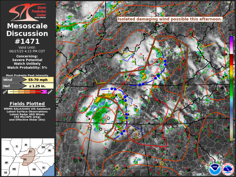
The Storm Prediction Center has issued a mesoscale discussion highlighting the potential for localized damaging winds this afternoon across parts of central and eastern Kentucky, middle and eastern Tennessee, northern Alabama, and extreme northwest Georgia. A severe weather watch is not expected at this time.
As of early afternoon, one cluster of thunderstorms is ongoing across parts of middle Tennessee into northern Alabama, with another cluster across central Kentucky. Although deep-layer shear is weak, some outflow consolidation has been observed with both systems. Additional storm development is possible along and just behind these outflows as the afternoon progresses.
The combination of seasonably cool temperatures aloft and a very warm, moist boundary layer is producing strong instability, with mixed-layer CAPE values of 3000–4000 J/kg in areas unaffected by earlier convection. This environment supports the potential for vigorous storm development capable of producing localized downbursts and small to near-severe hail. Residents in the affected areas should remain alert for rapidly changing weather conditions.
Category: Alabama's Weather, ALL POSTS, Social Media
About the Author (Author Profile)
Scott Martin is an operational meteorologist, professional graphic artist, musician, husband, and father. Not only is Scott a member of the National Weather Association, but he is also the Central Alabama Chapter of the NWA president. Scott is also the co-founder of Racecast Weather, which provides forecasts for many racing series across the USA. He also supplies forecasts for the BassMaster Elite Series events including the BassMaster Classic.Subscribe
If you enjoyed this article, subscribe to receive more just like it.


