Midday Nowcast: Rain Chances Decreasing; Tropical Mischief Chances Increasing
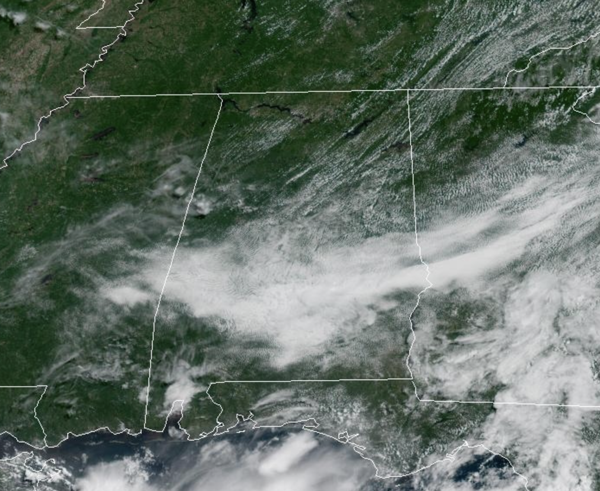
DRIER AIR SLIPPING IN: A weak front is dropping south through the state, and behind it, drier air is filtering into the Alabama. Rain chances are much lower today, especially across the northern half of the state. Rain chances are a bit higher today for the southern half of the state. For much of Alabama, we are seeing more sun than clouds today with highs in the upper 80s and lower 90s.
BIRMINGHAM ALMANAC: For July 2nd, the average high for Birmingham is 90° and the average low is 71°. The record high is 101° set in 1954, while the record low is 57° set in 1924. We average 0.18” of precipitation on this date and the record value is 2.43” set in 1989.
THROUGH INDEPENDENCE DAY WEEKEND: With the drier in place, showers if any, will be few and far between tomorrow, Friday, and Saturday. Expect lots of sunshine and slightly higher heat levels. Highs will be in the low 90s for most places, but humidity levels will be lower. The chance of thunderstorms through Saturday is not zero, but generally less than 10%. Any showers are likely to be over the southern quarter of Alabama. Rain chances will be slightly higher on Sunday as we watch the stalled front in the northern Gulf.
NEXT WEEK: Moisture levels will continue to slowly rise, and the week will feature very routine summer weather. Partly sunny days with scattered, mostly afternoon and evening showers and thunderstorms. Highs will be close to 90 degrees, which is right where temperatures should be for early July in Alabama.
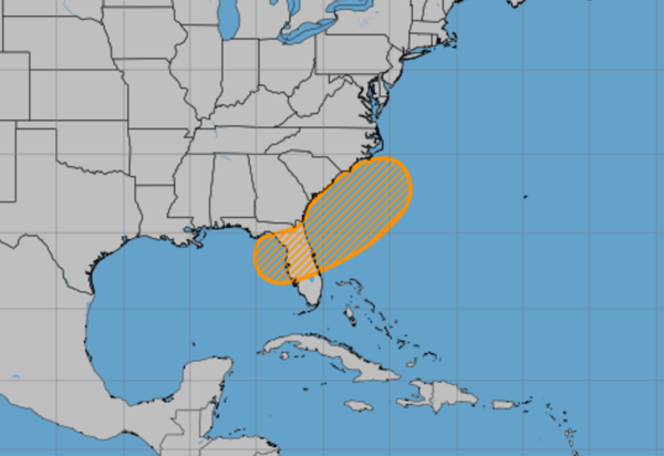
IN THE TROPICS: As the front stalls off the Gulf and Southeast U.S. Coast, an area of low pressure could develop along the weakening frontal boundary. Environmental conditions appear only marginally conducive for some slow development, but a tropical or subtropical depression could form in this region over the weekend or early next week while the system moves little. Regardless of development, heavy rainfall is possible across portions of the southeast U.S., particularly across the west-central Florida coast. Formation chance through 7 days…medium…40 percent. The next name up is Chantal. The rest of the Atlantic Basin is quiet.
BEACHBOUND: Great weather along the Alabama and Northwest Florida Gulf Coast this weekend. Highs will be in the low 90s, and the days will feature more sun than clouds. That is causing the UV Index to be extreme, meaning there is an extreme risk of harm from unprotected sun exposure. Take all precautions. Unprotected skin can burn in minutes. Beachgoers should know that white sand and other bright surfaces reflect UV and will increase UV exposure. Try to avoid sun exposure between 10 a.m. and 4 p.m. Seek shade, cover up, wear a hat and sunglasses, and use sunscreen. The risk of rip currents is low, however, life threatening rip currents may still occur especially near jetties, reefs, and piers. Always swim near a lifeguard and remember to heed the advice of the local beach patrol and flag warning systems. And know near the Panama City area, the rip current threat is moderate. That potion of the Gulf Coast always has higher rip currents than the rest of the coast due to the northwest to southeast layout of the shore. Water temperatures up and down the coast are in the mid-80s, which are perfect for me! Rain chances will start to increase by the end of the weekend, as we watch for potential tropical mischief.
WORLD TEMPERATURE EXTREMES: Over the last 24 hours, the highest observation outside the U.S. was 121.3F at Tabas, Iran. The lowest observation was -93.6F at Concordia, Antarctica.
CONTIGUOUS TEMPERATURE EXTREMES: Over the last 24 hours, the highest observation was 118F at Stovepipe Wells and Death Valley, CA. The lowest observation was 33F at Leadville, CO.
Category: Alabama's Weather, ALL POSTS, Social Media
About the Author (Author Profile)
Macon, Georgia Television Chief Meteorologist, Birmingham native, and long time Contributor on AlabamaWX. Stormchaser. I did not choose Weather, it chose Me. College Football Fanatic. @Ryan_StinnetSubscribe
If you enjoyed this article, subscribe to receive more just like it.


