Hot & Humid; A Few Strong Storms Possible Up North
HOT & HUMID WEEKEND
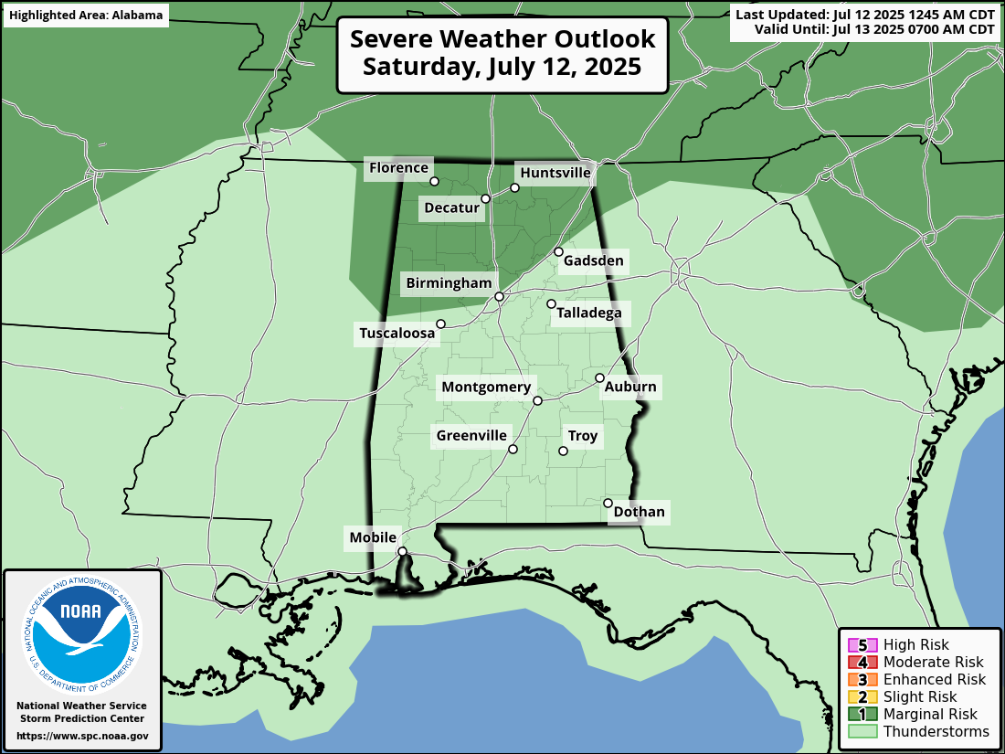
It’s a steamy Saturday across the state, with a mix of sun and building clouds giving way to scattered afternoon thunderstorms. The Storm Prediction Center has placed North and parts of Central Alabama under a Marginal Risk (Level 1 of 5) for strong to possibly severe storms. The biggest threats today are brief damaging wind gusts, heavy rainfall, and lots of lightning — especially where instability builds into the early afternoon. Storms should wind down by evening. Highs will reach the upper 80s to lower 90s.
On Sunday, the ridge of high pressure strengthens a bit, lowering rain chances and pushing heat indices closer to dangerous levels. Only isolated afternoon storms are expected, so most of us stay dry — but it’ll be hot. Humidity will make it feel more like 100 to 105 in some locations. Be sure to stay hydrated and take breaks if you’re outdoors. Afternoon highs will climb into the lower to mid 90s.
MOISTURE LEVELS & RAIN CHANCES RISE
We stay locked in this summer pattern to start the workweek. Heat and humidity will remain high, with only a few widely spaced storms possible during the afternoon and early evening hours. A weak front hovering near the Tennessee state line won’t have much influence on our weather. It will still feel uncomfortable outdoors for long periods. Expect highs once again in the lower to mid 90s.
Tuesday shows moisture levels start to tick upward again, and that means a slightly better chance of scattered storms, especially in the afternoon. Coverage won’t be widespread, but some downpours could be locally heavy due to slow-moving cells. Still, many areas will remain dry and sunny for much of the day. The heat remains stubborn, with afternoon temperatures in the mid 90s.
Forecast confidence dips a bit midweek as we watch a disturbance near the Bahamas. If it pushes west into the Gulf, we could see increased clouds and more widespread storms. For now, scattered afternoon storms are in the forecast, especially across southern counties, with the potential for brief heavy rain and gusty winds. Highs will settle in the lower 90s.
That same system could push even closer on Thursday, bringing better rain coverage across the region. More clouds and a good chance of afternoon and evening storms would help trim down the daytime heat. While it won’t be a washout, expect more interruptions for outdoor plans and a better chance of rain-cooled relief. Highs will likely top out in the upper 80s to near 90.
We’ll keep that more unsettled pattern going to wrap up the week. Expect a mix of sun, clouds, and a higher chance of afternoon storms, especially if moisture from the Gulf continues to drift north. It’ll still be humid, but the increased rain chances could hold highs in check. Afternoon temperatures should remain in the upper 80s to around 90.
POSSIBLE DISTURBANCE TO MOVE OVER TH GULF
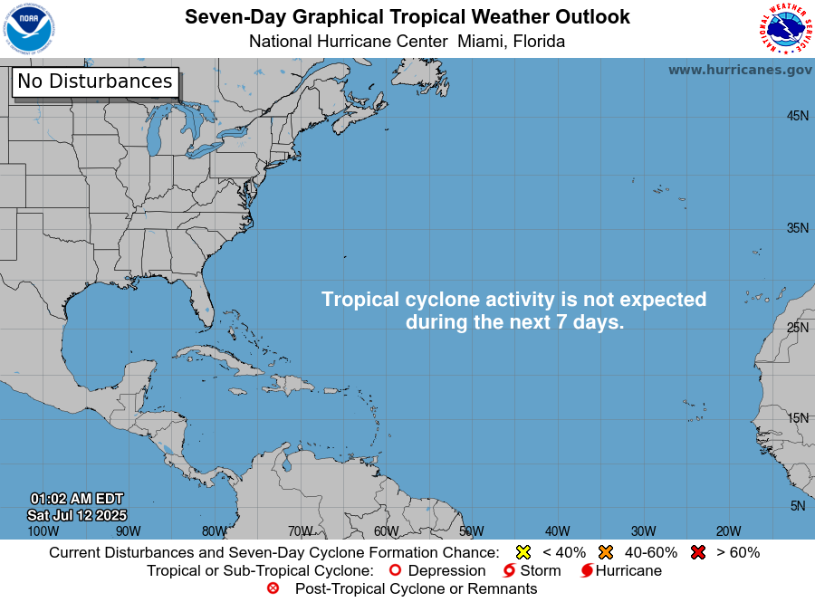
The tropics are behaving for now — no tropical development is expected over the next seven days across the Gulf of Mexico, Caribbean Sea, or Atlantic Ocean. However, we are watching a surface trough near Florida that may drift westward and bring a bump in rain chances along the Gulf Coast. While not expected to organize, we’ll keep an eye on it just in case.
Category: Alabama's Weather, ALL POSTS, Severe Weather, Social Media, Tropical, Weather Xtreme Videos
About the Author (Author Profile)
Scott Martin is an operational meteorologist, professional graphic artist, musician, husband, and father. Not only is Scott a member of the National Weather Association, but he is also the Central Alabama Chapter of the NWA president. Scott is also the co-founder of Racecast Weather, which provides forecasts for many racing series across the USA. He also supplies forecasts for the BassMaster Elite Series events including the BassMaster Classic.Subscribe
If you enjoyed this article, subscribe to receive more just like it.


