Midday Nowcast: Heat Advisory and Tropical Mischief
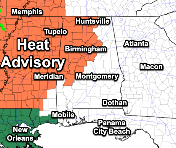
HEAT ADVISORY: Hot and humid weather with highs in the mid to upper 90s, and heat index values are ranging from 102°-108° across the state. Anything over 105° is in the danger range for North and Central Alabama, for that reason a Heat Advisory has been issued for portions of Alabama.
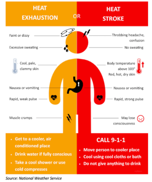
We all know how to stay cool, but here is a reminder of heat illnesses and if you feel any of these symptoms, take action immediately. In case you didn’t know, heat is the number one weather related killer each year, so take it seriously.
The only heat relief will come from a few afternoon and evening showers and thunderstorms in random spots. Rain chances today and tomorrow are only in the 20-40% range, but will increase to the 50-70% range by Friday and highs should drop back into the low 90s.
BIRMINGHAM ALMANAC: For July 16th, the average high for Birmingham is 91° and the average low is 72°. The record high is 105° set in 1980, while the record low is 55° set in 1967. We average 0.17” of precipitation on this date and the record value is 2.65” set in 1971.
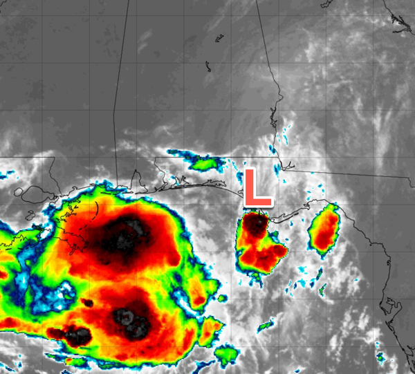
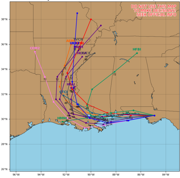
WATCHING THE GULF: Invest 93L continues to track westward over land. Surface and radar observations indicate that a broad area of low pressure is moving westward across the Florida Panhandle between Tallahassee and Panama City. The associated shower and thunderstorm activity is disorganized and located mainly south and southwest of the center. This system is forecast to continue moving westward, and could emerge or redevelop over the far northeastern to north-central portion of the Gulf later today or tonight, reaching the coast of Louisiana by Thursday. If this system moves far enough offshore, environmental conditions over the Gulf appear generally favorable for additional development, and a tropical depression could still form over the next couple of days before the system moves fully inland by the end of the week.
Regardless of development, heavy rainfall could produce localized flash flooding over portions of Florida through today. Heavy rainfall could also cause flash flooding for portions of the north-central Gulf Coast beginning late today and continuing through Friday. For additional information, please refer to products issued by the Weather Prediction Center and your local National Weather Service office. Formation chance through 48 hours…medium…40 percent. If the system develops into a named storm it would be Dexter. The rest of the Atlantic is quiet for now.
USA BRIEF: Heavy rainfall and flash flood threat continues for portions of the Mid-Atlantic west into the Ohio Valley Wednesday. Heavy downpours and flash flooding expected with a tropical disturbance moving along the north-central Gulf Coast through mid-week. Potent summer storm system to bring flash flooding and severe weather threat to the Midwest and northern/central Plains Wednesday. Heat threat building across much of the eastern U.S. through at least mid-week.
WEEKEND AND BEYOND: This classic summer weather pattern continues with morning sunshine, followed by scattered afternoon and evening storms. Most of the storms will come from 1PM-10PM. Highs over the weekend will be in the low 90s. The pattern will likely continue through most of next week; we are in that time of the year when the weather simply doesn’t change much, the ole “Dog Days of Summer.”
WORLD TEMPERATURE EXTREMES: Over the last 24 hours, the highest observation outside the U.S. was 122.6F at Basrah International Airport, Iraq. The lowest observation was -106.6F at Vostok, Antarctica.
CONTIGUOUS TEMPERATURE EXTREMES: Over the last 24 hours, the highest observation was 122F at Stovepipe Wells, CA. The lowest observation was 34F at Olney and Polebridge, MT.
Category: Alabama's Weather, ALL POSTS, Severe Weather, Tropical
About the Author (Author Profile)
Macon, Georgia Television Chief Meteorologist, Birmingham native, and long time Contributor on AlabamaWX. Stormchaser. I did not choose Weather, it chose Me. College Football Fanatic. @Ryan_StinnetSubscribe
If you enjoyed this article, subscribe to receive more just like it.


