Building Heat and Gulf Moisture Set the Stage for this Week’s Forecast
NO VIDEO TODAY BECAUSE OF ALABAMA WEATHER NETWORK PREP – WE DEBUT AUGUST 11TH!
It’s the third weekend of July, and Alabama is deep into summer’s steam. The calendar says we’re approaching the climatological peak for heat and humidity, and this week will bear that out. After recent flooding rains and storms tied to the remnants of a tropical low, we shift into a more classic July pattern: building ridging, rising temperatures, and daily chances of storms. There’s no widespread severe weather threat or tropical trouble for Alabama in the near term, but summer’s grip is tightening, and the week ahead will demand attention to heat safety.
GULF LOW FADING, BUT MOISTURE REMAINS
The surface low that brought flooding rain to parts of the state Friday into early Saturday is now a remnant swirl over Mississippi and Louisiana, and it will continue to weaken. Deep tropical moisture remains in place, with precipitable water values still around 2 inches, and will fuel scattered to numerous showers and storms again today, especially in the afternoon. Coverage won’t be as widespread as Friday, but where storms form, they could still produce locally heavy rain, gusty winds, and lightning. Storm motion will be slow, so localized flash flooding remains a possibility.
SUNDAY AND SUNDAY NIGHT
Expect a mix of clouds and sun across the state today, with scattered to numerous showers and storms developing after midday. Highs will range from the upper 80s in areas that get more persistent cloud cover and rainfall, to low 90s where sunshine dominates. Heat indices may push to 100–104°F in drier areas. Storms will gradually taper after sunset, with lingering showers ending by midnight. Overnight lows will settle into the mid 70s under partly cloudy skies. Fog is not expected to be a major issue due to continued cloud cover and light mixing.
THE WEEK AHEAD: BUILDING HEAT AND DAILY STORMS
As we head into the new workweek, the upper ridge begins to expand eastward from the Southern Plains and lower Mississippi Valley, bringing a warming trend. Highs Monday through Wednesday will climb into the low to mid 90s statewide, and heat index values will range from 101–108°F, with some locations potentially touching 110°F by midweek. There will still be scattered storms, particularly in the afternoon and evening, but coverage will begin to decline slightly as subsidence increases. Rainfall amounts each day will vary, but localized 1–2″ totals are possible. By late in the week, storm coverage may dip further, allowing more sunshine and hotter temperatures.
NEXT WEEKEND: DANGEROUS HEAT POSSIBLE
Long-range guidance suggests the ridge may strengthen further by next weekend, reducing storm chances even more and pushing highs into the mid to upper 90s. If dewpoints remain in the low to mid 70s, we could see heat index values exceeding 110°F in places, triggering Heat Advisories or Excessive Heat Warnings. Nighttime lows will struggle to drop below the upper 70s in urban areas, adding to heat stress. Outdoor activity will need to be adjusted accordingly, and now is the time to prepare for a potential multiday heat wave.
PEEKING INTO VOODOO TERRITORY
Looking into the last few days of July and into early August, ensemble trends keep the ridge in place across much of the central and eastern U.S., with a possible weakness along the Gulf Coast. That could allow for scattered daily storms to persist, but the overarching story appears to be continued above-average temperatures. The Climate Prediction Center highlights much of the Southeast for a High Risk of Much Above Normal Temperatures from July 25–26 and a Moderate Risk from July 25–31, with highs near or exceeding 97°F increasingly likely.
SEVERE WEATHER OUTLOOK
The Storm Prediction Center does not highlight any significant risk areas for severe weather today. However, isolated strong storms are possible from central Alabama northward into Tennessee and eastward along the Mid-Atlantic coast. Any storm could produce gusty winds, lightning, and brief heavy downpours. Widespread damaging wind or large hail is not expected.
TROPICAL WEATHER OUTLOOK
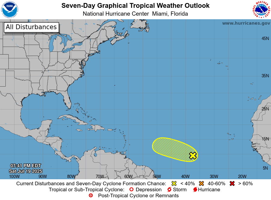
The tropics are relatively quiet for now. The low that moved into the Gulf and then inland is no longer a concern. However, the National Hurricane Center is monitoring a tropical wave in the Main Development Region (MDR), several hundred miles west-southwest of the Cabo Verde Islands. Environmental conditions are marginally favorable for some slow development as the system moves westward at 10–15 mph. The NHC gives it a low 20% chance of development over the next 7 days. No immediate threat to land, but it’s worth keeping an eye on.
BEACH FORECAST: HOT, HUMID, AND RIP CURRENT RISK
The beautiful beaches of Alabama and northwest Florida will see a mix of sun and clouds today, with scattered storms likely, especially during the afternoon hours. Highs will top out in the upper 80s to low 90s, with heat index values well into the 100s. Gulf water temperatures are near 86–88°F. The rip current risk is moderate along the entire stretch from Gulf Shores to Panama City Beach. Always swim near a lifeguard and pay attention to local beach flags. Thunderstorms may briefly turn severe with gusty winds or dangerous lightning.
ACTIVE STORM TRACK MEETS OPPRESSIVE HEAT IN MID-JULY MASHUP
A classic midsummer “Ring of Fire” pattern is firmly in place across the eastern two-thirds of the nation, with an expansive upper ridge baking the Southeast and a potent west-to-east jet stream fueling rounds of thunderstorms across the Midwest, Ohio Valley, and Mid-Atlantic. Dangerous heat continues to grip the South and expand into the Central U.S., with heat indices reaching as high as 115°F and no real relief in sight. Meanwhile, a stalled frontal boundary interacting with tropical moisture will trigger widespread thunderstorm activity—some capable of producing 3 to 8 inches of rainfall—across areas like Kentucky, southern Illinois, West Virginia, and parts of Virginia. Flash flooding remains a significant concern, while severe thunderstorms capable of damaging winds and hail are expected from the Dakotas to New England. Out West, dry heat persists with scattered monsoonal thunderstorms across the Southwest, while the Pacific Northwest remains relatively quiet under weak upper ridging. The week ahead will see the heat dome expand deeper into the Ohio Valley and southern Plains, with storm tracks staying active along its northern rim.
DANCIN’ WITH THE STATS
The heat didn’t let up overnight in Central Alabama. On Friday, Birmingham tied its record high minimum temperature for July 18th with a low of 77 degrees, matching a mark first set in 1903. Anniston tied their record with 74. Tuscaloosa broke their record with 77. When even the nights refuse to cool down, it’s a clear sign that the atmosphere is holding onto every bit of summer heat.
WEATHERBRAINS PREVIEW
Monday night’s episode of WeatherBrains is a special tribute to the late, great Gary England — a legendary figure in American broadcast meteorology. Known for his pioneering work at KWTV in Oklahoma City, Gary was among the first to use Doppler radar on television and became a beloved, trusted presence in homes across Tornado Alley for decades. Joining the show to share their memories and insights will be Lacey Swope and David Payne from News 9 in OKC, along with Barbara Merckx, who worked alongside Gary and now oversees OU Nightly, the daily student-led newscast in Norman. Expect a meaningful conversation about Gary’s impact on severe weather communication and how his legacy continues to shape the next generation. The show streams live at 7 PM CDT Monday on YouTube.com/WeatherBrains, and episodes are also available on WeatherBrains.com and all major podcast platforms.
ON THSI DATE IN 1997: Hurricane Danny lashed the Alabama Gulf Coast with 80 mph winds as the storm stalled over the southern end of Mobile Bay, dumping an astonishing 30 inches of rain across Mobile and Baldwin Counties. Dauphin Island Sea Lab recorded a staggering 36.71 inches, including 25.98 inches in just seven hours — one of the highest short-term rainfall totals in U.S. history. The storm caused extreme flooding, killed two people during storm preparations, and destroyed a four-story condominium under construction in Gulf Shores. In an iconic moment of resilience, a couple held their wedding at the Marriott Grand Hotel in Point Clear despite the storm, even though the power was out and a bridesmaid couldn’t make it to the ceremony.
Category: Alabama's Weather, ALL POSTS, Social Media
About the Author (Author Profile)
Bill Murray is the President of The Weather Factory. He is the site's official weather historian and a weekend forecaster. He also anchors the site's severe weather coverage. Bill Murray is the proud holder of National Weather Association Digital Seal #0001 @wxhistorianSubscribe
If you enjoyed this article, subscribe to receive more just like it.


