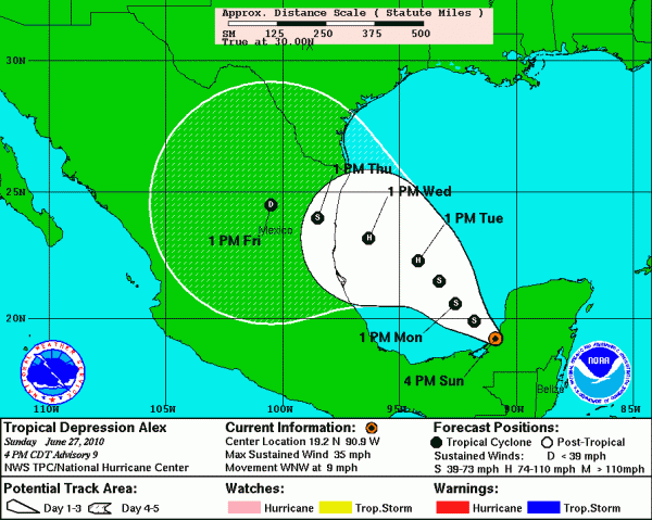
Alex at 4 p.m.
THE LATEST just emerging back into the Gulf of Mexico.
…Large, well defined circulation though, will intensify once it gets over water
…Forecast is shifted a little to the right, with lower confidence because of model disagreement
…Models are in two camps based on their predictions about the ridge over the northern Gulf of Mexico
…GFS turns it more north and takes it to near Houston.
…The official forecast turns Alex into a hurricane by Tuesday morning and carries it to a landfall on the Mexican Coast about 125 miles south of Brownsville early Thursday morning as a 90 mph category 1 hurricane.
…Undoubtedly will intensify over the Southwest Gulf, although HWRF and GFDL models do not show intensification
…If it does turn more north, I am afraid it will generate 20-30 mph winds over the northern Gulf in the spill area. With a southerly direction, this could complicate recovery efforts.
…In any case, 2-4 foot swells will affect the northern Gulf, making recovery efforts more difficult.
Category: Uncategorized


