Capstone Forecast Update
Perhaps the forecast for Tuscaloosa has gotten clearer with the most recent radar trends.
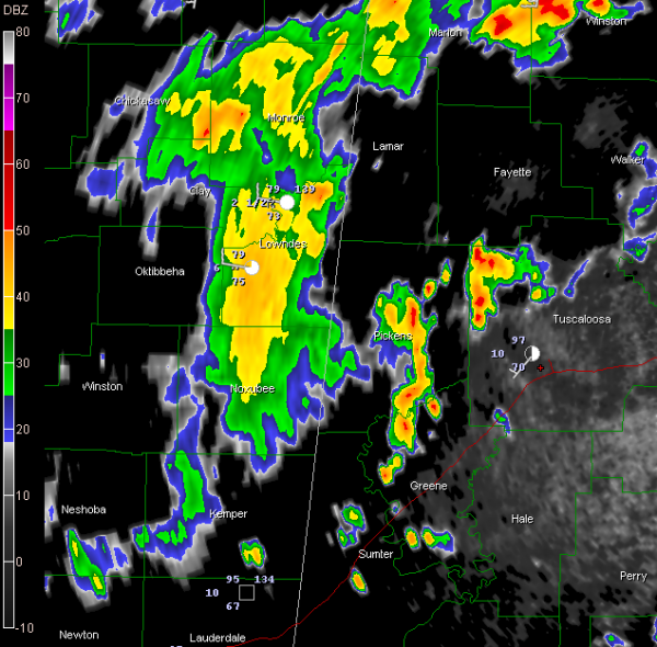
1. Showers have just fallen at the stadium at 330 and more are on the way Heavy showers over Pickens and Greene Counties will reach Tuscaloosa around 4 p.m. They will be heavy. Could have some lightning, even though they don’t right now. They’re getting close to being tall enough to do that.
2. Heavy showers near Macon MS will reach the stadium between 5:15 and 5:30 and last about 30-45 minutes. The lightning output with these showers has diminished tremendously in the past 30 minutes.
3. After that, maybe the rest of the game will be dry. But with the front still yet to arrive tonight, there could be development later and there are already showers building over western Mississippi.
Dark clouds are amassing on the horizon north and west of the Stadium. They are signs of things to come.
Category: Pre-November 2010 Posts


