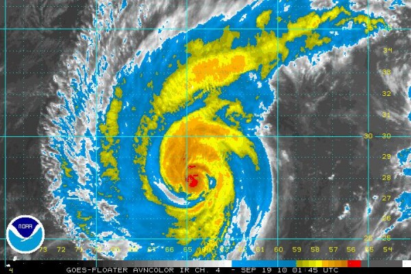
Conditions Deteriorating on Bermuda
It looks like the center of Hurricane Igor will pass very near the island of Bermuda Sunday evening.
The hurricane has weakened slightly, which is good news, but it is still a formidable category two hurricane. The official forecast track has been shifting ever so slightly to the west, increasing the likelihood that the island will find itself in the eastern eyewall. And the eastern semicircle is the most dangerous part of the hurricane.
With the faster speed, conditions are deteriorating rapidly on the island. Tropical storm force winds will begin shortly with strong tropical storm force winds (58 mph) by mid-morning. Hurricane conditions will begin about mid-afternoon and could last for 8 hours or so.
At last report (9 p.m. CDT), L.F. Wade International Airport was reporting rain, temperature 80F, dewpoint 75F, winds were ENE at 26 mph.
Conditions will improve quickly on Monday as Igor moves out to the northeast and becomes a major storm over the North Atlantic.
BERMUDA’S HURRICANE HISTORY: Bermuda gets a direct hit by a hurricane about every ten years. The last direct hit was Hurricane Fabian in September 2003, which produced $300 million in damage and killed 7 people. It certainly ranks as one of the three worst in the island’s history. Hurricane Emily in 1987 was one of the worst with wind gusts to 125 mph. A 1926 hurricane scored a direct hit, resulting in a 40 minute calm. Winds were measured to 125 mph. There were several fatalities on the island.
Category: Uncategorized


