

Update on Gabrielle and cold front
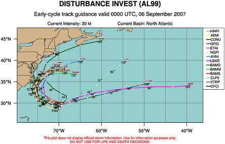
As far as the potential tropical storm Gabrielle in the Atlantic more than 500 miles off the east coast, a U.S. Air Force hurricane hunter aircraft investigated the storm Wednesday afternoon, and found maximum flight-level winds of only 33 knots, so the system is not a tropical storm yet. The system is not well organized, with most of the rain to the E of the center. Check out WINDSAT satellite image (courtesy Naval Research Lab) from Wednesday afternoon, which shows an estimate of winds at the ocean surface in areas away from rain. One can see the broad counterclockwise circulation here.

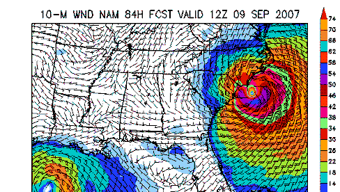
Most computer models do intensify this system to tropical storm status by late Thursday, and NHC feels that development is possible as the environment becomes more favorable. Most models bring this storm near or on to the North Carolina coast by Sunday. It bears watching, especially if rain begins to wrap around the entire system and development begins to occur.
As far as the possibility of a cold front coming in here next week, it will be close. Latest 00 UTC GFS shows enough of an upper level disturbance to help develop and drag a cold front into the Southeast by Tuesday. If this happens, there would be a good chance for rain and thunderstorms Tuesday. The front still looks like it will lose some of its southward push by the time it gets into Tennessee, so it may stall just north of here, or come into Alabama weaker. GFS does indicate lows in northwest Alabama could reach the 50s by Wednesday and Thursday mornings, so we’ll see! Don’t worry, the cool air will come in here fairly soon! It is really starting to cool off now over the Arctic and northern Canada.
Category: Uncategorized
About the Author (Author Profile)
Subscribe
If you enjoyed this article, subscribe to receive more just like it.


