Changes Ahead
What a gorgeous day! Blue skies, bright sunshine, warm temperatures and a fresh southeasterly breeze made for a spectacular Sunday weatherwise across Central Alabama. Temperatures were in the lower and middle 80s at mid-afternoon, including 86F at Tuscaloosa. The only negative is just a hint of smoke smell at times, from either inappropriate burning or wildfires. The fire danger is still high, so avoid outdoor burning.
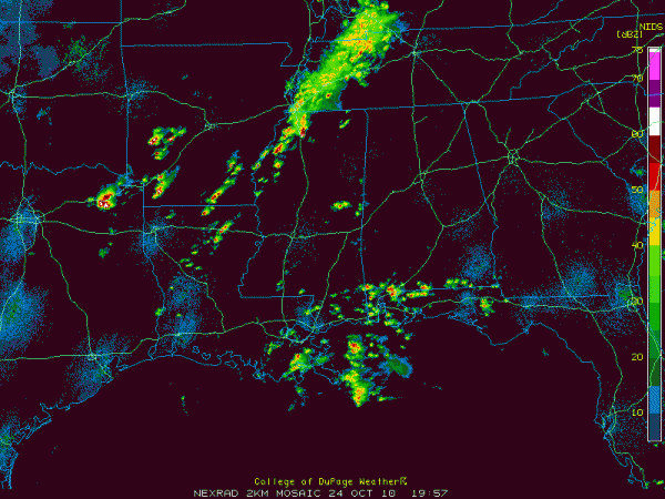
Changes are on the way however. Clouds are already on the increase across the area, the result of moisture surging northward on those southerly winds. Showers and thunderstorms will spread in from the south and west and increase tonight thanks to an approaching upper level disturbance. Rain should become fairly widespread later tonight. By morning, many spots will pick up an inch of rain.
Tornado watches are in effect now to the west of Alabama over parts of Arkansas, Louisiana, Texas and Oklahoma. In Alabama, some of the storms could be strong to severe tonight. Keep a weather eye open through the overnight hours.
Showers and storms will push eastward on Monday morning, leading to some clearing by afternoon. Most areas west of I-65 will pick up another half inch of rain Monday morning, with heavier amounts to the east. Strong storms will break out again Monday afternoon, but should be mostly southeast of our area. A warm, very moist airmass will remain in place over Alabama on Tuesday and Wednesday and that means more storms ahead of a strong cold front. They could be strong to severe again Tuesday night and Wednesday morning.
Category: Uncategorized


