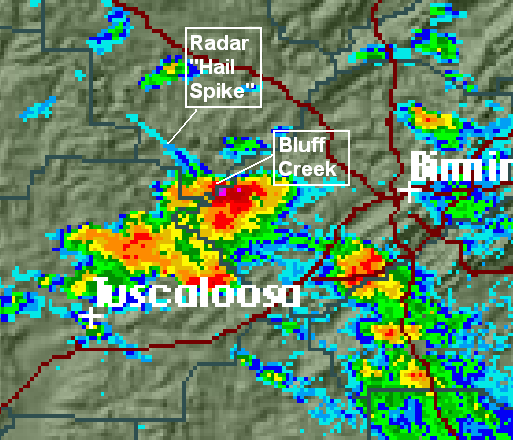
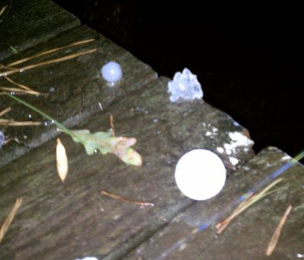
Hail spike, large hail at Bluff Creek
This radar picture is from about 1048 pm, when near golf ball size hail was falling along the Warrior River at Bluff Creek (see picture below). A friend of mine there said it looked like the “river was boiling”.
Note the line of radar reflectivity NW of the storm. That is called a “hail spike”, and is caused when hail stones are large enough that some of the radar beam bounces off the hail to the ground, back to the hail stones, then back to the radar. Since the radar uses timing of return to calculate distance, this delay makes the radar think there’s rain out beyond the storm. Notice the second shade of purple, meaning the reflectivity is 70 dBZ, about as high as you ever see, and usually associated with large hail.
Category: Met 101/Weather History


Comments (1)
Trackback URL | Comments RSS Feed
Sites That Link to this Post