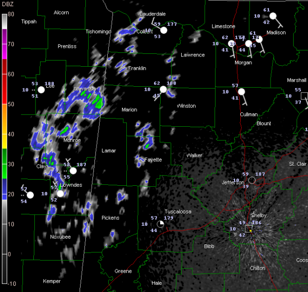
Overnight Showers
A weakening cold front likes just inside the Alabama/Mississippi border late tonight.
Light showers cover parts of Pickens, Fayette, Winston and Lawrence Counties. Slightly heavier showers extend from just east of Tupelo into the Columbus MS area. These showers will continue to move northeast and will produce light rain over parts of Lamar and Marion Counties over the next couple of hours.
Showers will fizzle as we go through the overnight hours. By morning, they should become more isolated. Most of Sunday will be dry before rain returns late Sunday night through all of Monday and Tuesday. A few storms will be mixed in, with the possibility of a few strong storms around noon on Tuesday. It could be windy on Tuesday, as the low pressure system that will be moving across the area is expected to be stronger and further north than we earlier thought.
Cooler and drier weather will follow for the rest of the week.
Category: Alabama's Weather


