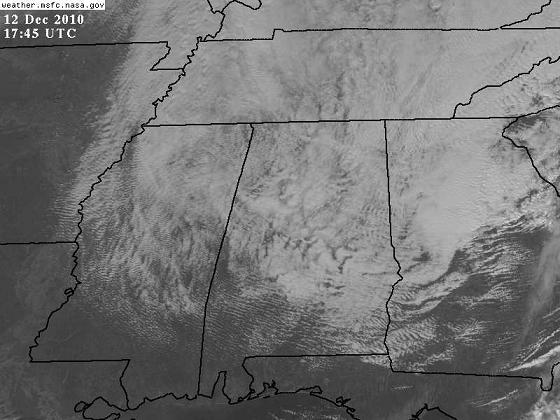
Snow analysis – 1230 pm
Radar and satellite continue to indicate snow showers over north and central Alabama early this afternoon. These snow showers are more like afternoon showers in the summer than normal snow…they are being caused by instability in the atmosphere!
Right now, it is 31 degrees at BHM at the ground, but it is 8 degrees at 4,000 feet, so the air is unstable! Therefore, snow showers have been forming all morning, and will continue for a while this afternoon. You can see the “convective” nature of the snow showers in the visible satellite. Notice how the clouds look kind of bubbly. It may snow moderately for a while, when you’re under an updraft, and then it may stop for a little while, when you’re under a downdraft. Neat stuff!
As the moisture moves out of the area later this afternoon and tonight, snow showers will end from west to east. A few spots, especially in higher elevations, may see a dusting, but any significant travel issues should be north of a line from Russellville to Vinemont to Piedmont, and even there it won’t be 1993 or anything.
Category: Met 101/Weather History


