Snow showers continue
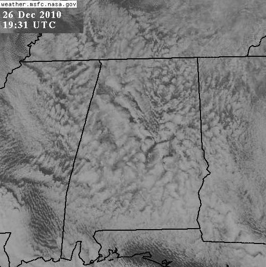
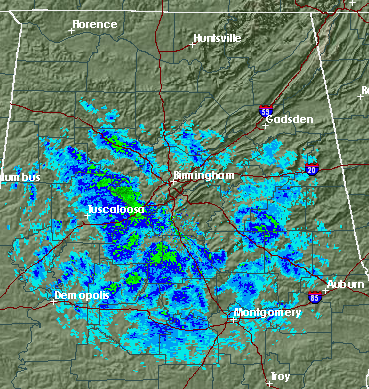
Check out the very unique look to the satellite and radar pictures this afternoon. As we mentioned yesterday, very cold air would move in overnight around 5,000 feet, making the air unstable near the ground like it is in Summer. In summer, it’s usually 90 degrees at the ground 65 degrees at 5,000 ft. Today, according to the NWS sounding, it was 5 degrees at 5,000 feet, and it’s about 32 at the surface, about the same rate of change as June! Wow. This, along with low-level moisture wrapping around the big storm system, is bringing snow showers to much of north and central Alabama again today. Notice how sometimes it snows, then the sun comes out, then it snows again? You can see this pattern in the satellite picture above.
The temperature of -15 C (5 F) at 850 mb (5,000 ft.) is one of the coldest I’ve ever seen in BHM. So, even as it warms slowly and the moisture pulls away, we’ll still have a few more snow showers this afternoon and into the evening, and some spots may even pick up another 1/4″ of snow or so.
Temperatures are near freezing now, but will fall into the 20s quickly as the sun goes down, creating more road problems. Read Bill Murray’s posts below for all the reports of icy roads this morning. Some spots, especially bridges, may still be icy tomorrow morning until 10 or 11 am. A good afternoon to stay home.
Category: Winter Weather


