Mid-Morning Update
See our live radar composite of the winter storm:
Most of what you see over Alabama is NOT reaching the ground; it is evaporating into the cold, dry air near the surface.
A few mid-morning notes…
*Generally speaking, the storm is developing as expected. There has been severe weather along the Texas Coast this morning, and dynamic forcing is excellent.
*SPC believes we will have thunder with the snow and ice tonight, especially south of I-20. But, I would image there could be some reports of thundersnow north of I-20 late tonight as well, but it will be isolated.
*The new 12Z NAM is printing 0.58″ liquid with this event for Birmingham. Equates to heavy snow for North Alabama, and potentially a crippling ice event for some parts of Central Alabama tonight.
*This is NOT in the same league as the 1993 blizzard. But, I do believe we will see isolated 8 inch snow amounts over North Alabama, and the ice over Central Alabama was not a part of the 1993 storm; that one was all snow.
*NWS Jackson reports a pretty good coating of sleet and glaze on elevated objects at the Jackson, MS airport.
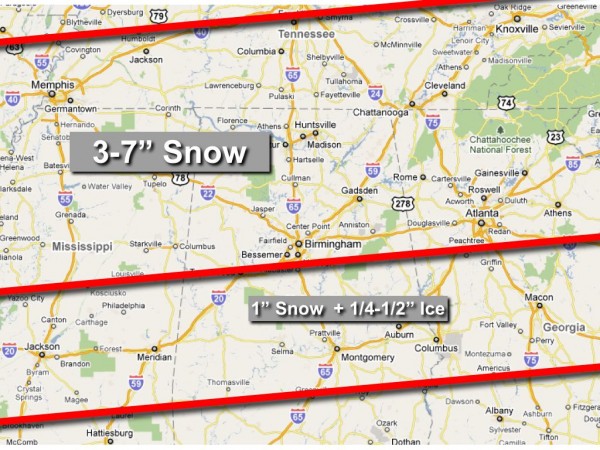
Our projected forecast below is not, more than likely, going to change before the event begins. Remember, travel will become difficult, if not impossible, tonight across much of Alabama north of U.S. 84. The most significant precipitation will come after 6:00, with snow and freezing rain heavy at times after midnight. Stay tuned for updates throughout the day….
Category: Alabama's Weather, Winter Weather


