Snow On The Increase
Roads across most of Central Alabama are a mess tonight as the winter storm continues to increase in intensity.
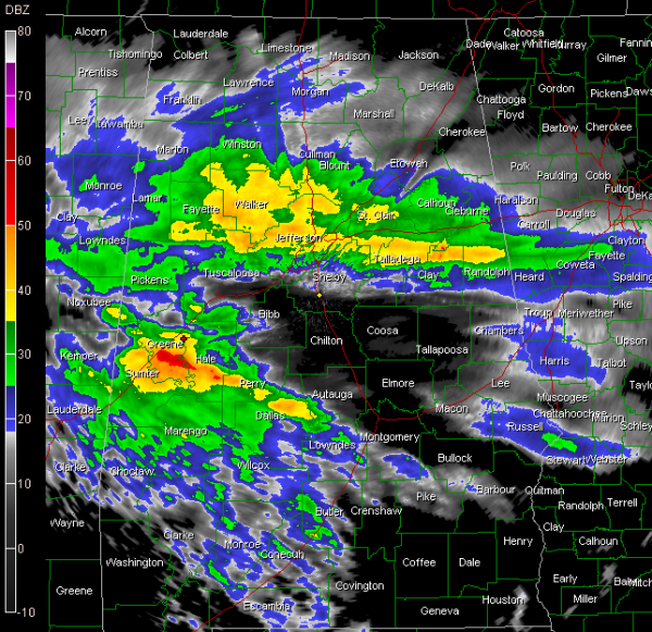
Precipitation is increasing tonight across North Central Alabama. Snow seems to be the predominant precipitation type across Lamar, Fayette, Walker northern Tuscaloosa and western Walker Counties. This band is building in areas about 25 miles north and south of I-20 from the City of Birmingham on to the east into Talladega, Clay and Randolph Counties. We may see some significant snow accumulations in this band.
It is moving northeast and will affect Cullman, Blount, St Clair, Etowah, Calhoun and Cleburne Counties for the next couple of hours.
Some reports from these areas…
…snowing not at Wildwood in Birmingham
…roadways covered with snow in Oak Grove in western Jefferson County
…heavy snow in West Point in Cullman County.
…snowing like crazy in Cook Springs
…huge flakes in Talladega…1/2 inch on ground
…snowing in Pleasant Grove
…snow in Reform
…snowing in Odenville…
…very heavy snow in Oxford
…Bessemer has changed back to sleet.
Precipitation is increasing quickly over West Central Alabama across Greene, Sumter, Hale, Marengo, Perry and Dallas Counties. This is likely sleet and freezing rain. We could see some thunder develop in this area. This will move northeast into Tuscaloosa, Bibb, Clanton and Autauga Counties.
EAST ALABAMA
Roads becoming treacherous in Cleburne County.
DO NOT DRIVE
You can now assume travel is hazardous in all areas under Winter Storm and Ice Storm Warning in Alabama. Please stay off the roads. There are numerous accidents, especially on roads which are elevated (bridges/overpasses.) We just receivedreport of MVA with possible fatality on highway 11 at Keenes Mill Road in Tuscaloosa County.
APPEAL
St Clair County EMA requesting volunteers with 4WD vehicles and good driving skills to help stranded motorists.
BIRMINGHAM AIRPORT
Saw a Twitter report that Southwest flights from Birmingham to Phoenix in the morning are canceled, including the 7 a.m. nonstop. Hope all our Auburn friends are already in Glendale.
NWS SNOW ACCUMULATION FORECAST
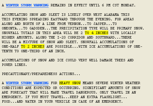
In the winter storm warning area, the NWS is now calling for 2-4 inches of snow.
Category: Alabama's Weather, Winter Weather


