Thundersnow – how it works
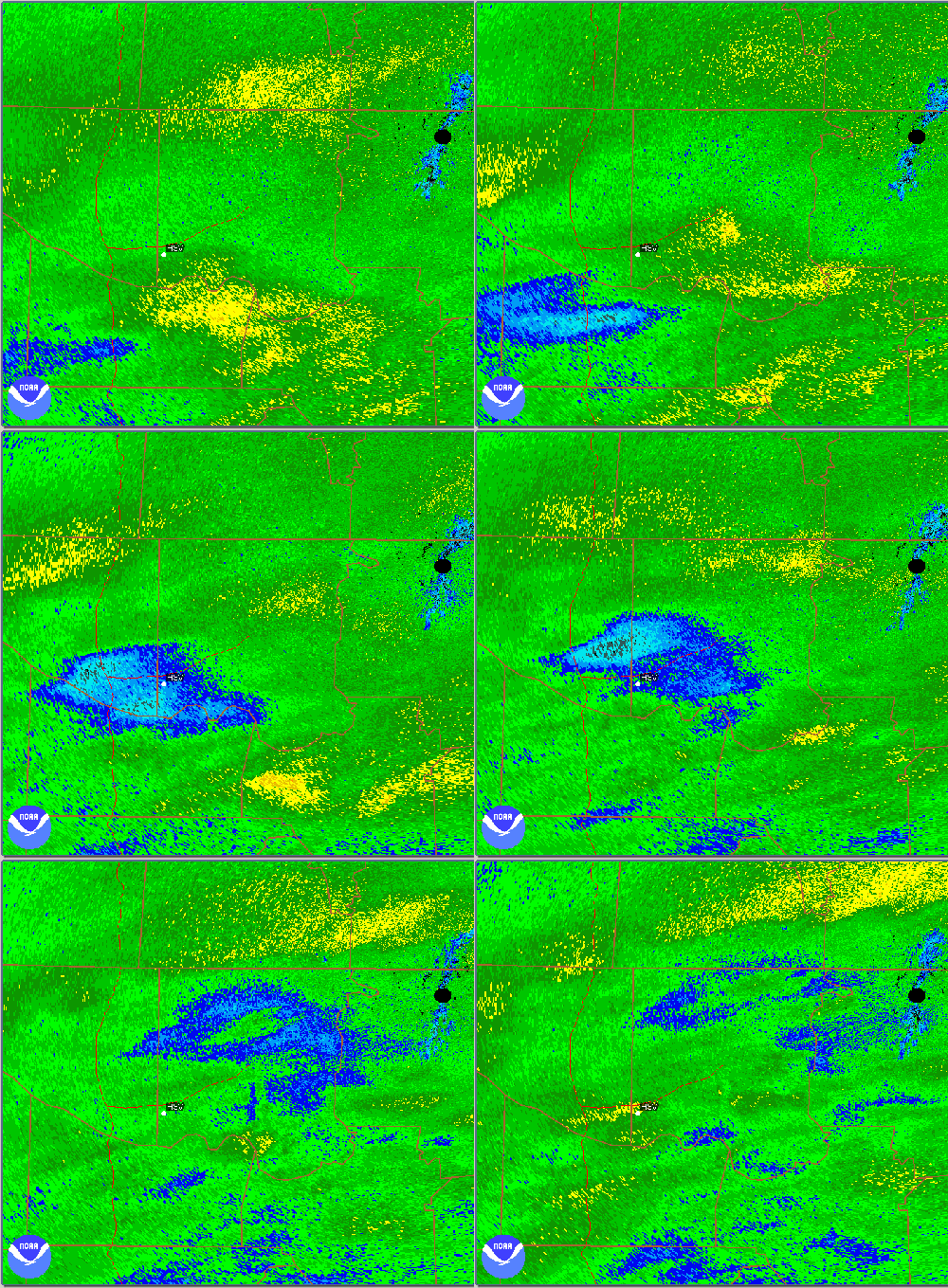
Radar loop 1125 pm to 1226 am during snowstorm. HSV airport is white dot
BHM SA 1050 W3X 1/16 TSW+BS 27/27/3316/953 T N OCNL LTGIC SNOINCR 2/8/11
KHSV 100553Z 06010G18KT 1/2SM TSSN FZFG OVC002CB M03/M03 A3012 OCNL LTGIC NE SNINCR 4/7
Lightning and thunder, occurring while it is snowing, is a very rare meteorological phenomenon. Only three times in my life (I’m 36 years old) can I remember it occurring in Alabama…April 1987, the Blizzard of 1993, and in last week’s winter storm. The two observations above are raw FAA weather observations. The first one, from the era of the old English observations, is from Birmingham at 1050 Z (4:50 am CST) on March 13, 1993. The keys are: “1/16 TSW+BS”, meaning 1/16 mile visibility in heavy snow with a thunderstorm, and “SNOINCR 2/9/11″, meaning 2” of snow in last hour, 9 in last 6 hours, 11 on ground. The second one is from Huntsville last week, in the new era of metric observations, or METARs. The keys: TSSN (thunder and snow), LTGIC (intracloud lightning), and SNINCR 4/7 (4 inches of snow in one hour, 7 on the ground).
Given the greatly reduced overall amount of water vapor in the atmosphere in winter, it is difficult here in the southeast to get 2″ or 4″ of snow in one hour without some help from convection. Without going into that too deeply now, convection occurs when the atmosphere is unstable, meaning when a parcel of air is vertically displaced by something, it will accelerate upward due its own buoyancy (i.e., the parcel is warmer than the air around it). Makes sense, right? If you open the freezer, the air sinks to the floor, if you open the oven, the hot air rises.
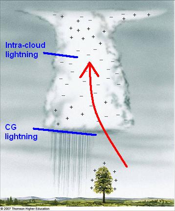
In the spring and summer, most convection is nearly vertical. The warm humid air near the surface rises in an unstable atmosphere (colder air aloft), and that air becomes warmer than the air around it, causing it to accelerate upward even faster, forming clouds, precipitation, and often lightning and thunder. The lightning forms due to positively-charged, lighter ice crystals (snow flakes) going high up in the cloud, and negatively-charged heavier ice pellets going lower in the cloud. Eventually, the charge builds up enough that it must discharge, like an arc across jumper cables if held too close together. Since the air is often warm and humid at low-levels and cold aloft and upper levels in the spring and early summer, that is when big storms are most likely.
Normally, in the winter, the upper levels cool some, but the lower levels cool a lot more, making the air stable to vertical displacements, and thunderstorms are rare. However, under a very specific circumstance known as conditional symmetric instability, or CSI, thunderstorms can form within otherwise stable, cold air.
The process is too complicated to explain thoroughly here. There are meteorologists that don’t understand it, and I teach it as part of my graduate Atmospheric Fluid Dynamics II class at UAH. The basic deal is this. When saturated, air parcels also release latent heat as water condenses/ice forms. A quantity known as equivalent potential temperature (theta-e) is conserved for an air parcel for any vertical motion and any condensation/evaporation. Also, except in cases of strong jet streaks north of a location, the atmosphere is stable to air crossing the isobars. This is called inertial stability; the air conserves momentum. When the lines of constant theta-e (solid) are sloped more in the vertical (meaning a large temperature gradient) than the momentum lines (dahsed) are (meaning no large jet stream nearby), CSI is present. See picture below.
(adapted from Chuck Doswell)
An air parcel starting at A, moving north (as most air above the surface was during the snowstorm), must stay on its line of constant momentum of 40 (inertial stability). But, as it moves north, its theta-e is conserved. So, it starts out at 310 degrees K and stays there. By the time it gets to B, the parcel is surrounded by air with a theta-e of 303 K, so it is warmer than the air around it and accelerates upward. This is the buoyant acceleration similar to that in summer thunderstorms that causes large updrafts, charge separation, and lightning and thunder.
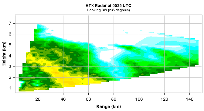
The storms are often more along a slant than straight up (like summer storms are). This was the case during the storms last week. Here is a cross-section, looking SW toward Hartselle, from the radar NE of Huntsville, at the beginning of the loop at the top of the blog. Notice how the storms lean north with height. The top of the storm near Huntsville is 40 km (about 25 miles) further north aloft than it is at the surface. There may also be gravity waves moving through, but further study is required to figure that out.
Category: Met 101/Weather History


Comments (8)
Trackback URL | Comments RSS Feed
Sites That Link to this Post