Early Morning Adjustments
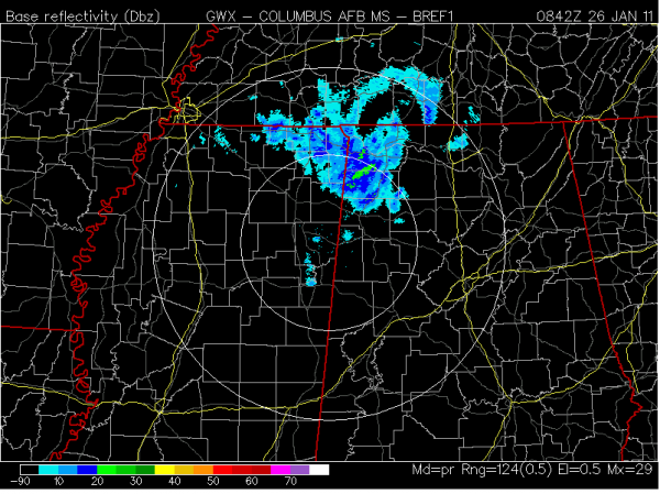
One thing we have known all along is that there are always surprises under upper-air lows; this time the surprise is a lump of coal for most instead of a nice white covering on the grass. I’ve received a report of a light dusting so far in northern Marion County and a Twitter report of some “good snow” coming down in Haleyville. That’s with this batch of precipitation that is intensifying just a little over the northwestern part of Alabama:
That is part of the deformation zone within the upper air low. Deformation zones are areas of high atmospheric wind shear and temperature contrast where clouds and precipitation are most likely. They’re downright impossible to measure using standard weather equipment because they’re so high up, and that’s why many times you get a “surprise” instead of a completely accurate forecast.
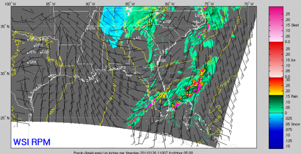
There is still computer model support for snowflakes (not enough for accumulation, though) as far south as Birmingham:
The bottom line here is that as we said yesterday, if adjustments needed to be made it would be for LESS snow instead of more snow. At this point, it looks like the best chance of a dusting to 1″ will come north of US 278; there will be few if any road issues as temperatures are well-above freezing.
Clouds will clear out by midday, and anything on the ground will melt as the high approaches 50º this afternoon. And for those folks who are sick of the wintry, wet, and cold, you have something to look forward to: highs in the 60s with some sun this weekend!
I’ll have a full update on ABC 33/40 starting at 4:30 AM on Good Morning Alabama. Until then, don’t expect too much wintry stuff around Birmingham, Tuscaloosa, Anniston, and points south. This will be a light event near and north of US 278 with few if any travel problems at all.
Follow me on Twitter: @simpson3340
Category: Alabama's Weather, Winter Weather


