Tennessee Snow
Thanks to Eric Jones for these images… he writes…
“James,
Hear are a few pics i took this morning while heading back to Birmingham from Nashville on my train.”
The best snow with the event early this morning was clearly in Tennessee…. with only a dusting for the northern third of Alabama. As stated here many times this week… there is little skill in handling cold core upper lows and the associated amount of snow. Similar setups have produced up to 10 inches in our state (March 2001), and others like this have produced very little.
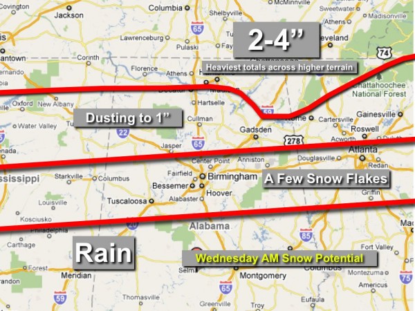
Here is a look at the final accumulation forecast potential before the event…
The “A Few Flakes” and “Dusting to 1 inch” zones weren’t bad… but the 2-4 inch line was too far south…. needed to be nudged up north about 30 miles. Again, considering the complexity of the situation, we won’t be able to do too much better. I had great fear of an upside surprise somewhere, so I was relieved when I woke up during the pre-dawn hours with a relatively quiet radar. The convection that formed last night had me a little nervous, often that is the atmosphere talking to us, and pretty much what we do during events like this is look for clues.
Turns out the main surprise was the lack of any really heavy snow directly under the cold core, although there were plenty of 3 inch totals over parts of West Tennessee.
Now we move on to some nice weather for the next few days… the next discussion and Weather Xtreme video will be posted by 3:30…
Category: Pictures


