Storms to Our West
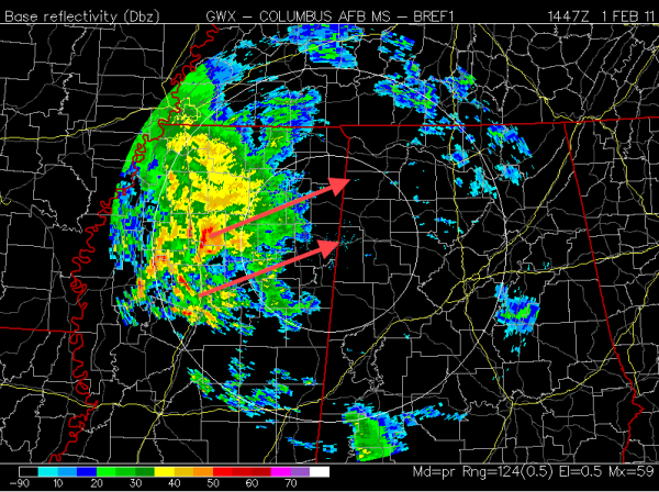
Checking the radar before 9 AM, a cluster of heavy thunderstorms is moving over north-central Mississippi, but it is just light rain for most of Alabama (except for the one lonely weak storm near the Clarke-Marengo County line). The storms near I-55 southwest of Tupelo are moving northeast around 60 MPH! They will enter northwest Alabama between 9 and 10 AM, and heavy rain as well as frequent lightning and thunder will accompany them into Lamar, Marion, Franklin, Colbert, and Lauderdale Counties.
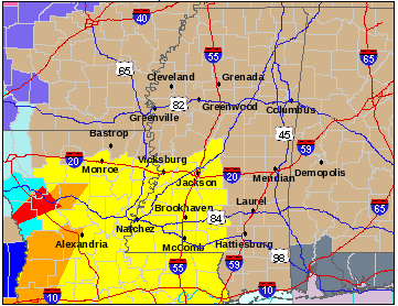
The air near the surface is relatively stable, so there is no chance of significant severe weather other than some small hail with these morning storms. Farther to the southwest, the atmosphere is rapidly destabilizing, and a tornado watch is in effect until 3 PM southwest of Jackson, Mississippi.
The Storm Prediction Center has placed most of Alabama in a *SLIGHT RISK* outlook for today; some strong or severe storms are a possibility between 3 PM in western Alabama to 10 or 11 PM in the east.
Keep up with us here on the blog, and get instant updates on Twitter. I’m @simpson3340!
-Jason
Category: Alabama's Weather, Severe Weather


