Strong Storms Down I-20
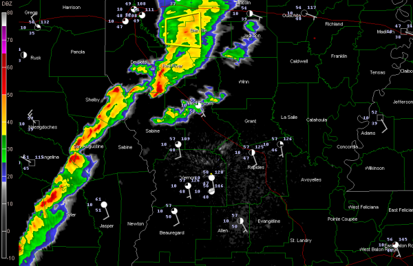
Some strong storms have broken out in the warm sector of that broad low pressure system and ahead of the cold front over eastern Texas tonight.
A severe thunderstorm warning is in effect for three parishes just south of I-20 in North Louisiana, between Shreveport and Ruston.
Storms are lined up to the southwest to near Coushatta and into eastern Texas west of Woodville.
Over Alabama, skies have been slow to cloud up, and temperatures have dropped quickly from some nice afternoon highs in the middle 50s. At 8 p.m., it was already 39F at Tuscaloosa, 40F at Birmingham and 35F at Anniston.
Indications are that this initial activity will weaken as it moves into Mississippi and may never make it into Alabama. The RPM model keeps us dry through 7 a.m. and waits until late morning for showers to develop across the state. rainfall amounts are expected to be very light, generally less than one tenth of an inch.
It also depicts the changeover to a mix of rain and snow by late afternoon continuing into the evening hours, but still shows no snowfall accumulation for North or Central Alabama Monday night.
Watching the output from the evening run of the NAM rolling in. In just awhile, we will start to see GFS output. It will be interesting to see what the models say about Wednesday night. The GFS has been getting more and more pessimistic about the possibility of snow for North Alabama Wednesday night.
Category: Alabama's Weather, Winter Weather


