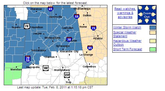
Snow analysis – 145 pm
All of the 12Z models are in now. No real big changes…an upper level disturbance will move into the SE US tomorrow, and a weak surface low will develop in the Gulf tomorrow night. This will produce precipitation over most of Alabama. Temperature profiles aloft are cold enough for mainly snow as far south as Cullman even when the first precipitation moves in late tomorrow afternoon, and with snow falling causing melting and evaporation, the atmosphere will become cold enough for snow in BHM by early evening, and in Clanton by midnight.
We feel pretty confident that Birmingham, Anniston, and Tuscaloosa will receive at least 1″ snowfall. With sunshine today and temperatures rising into the 40s tomorrow, travel problems may be limited to bridges and overpasses only, but it’s still early to tell that.
The difficulty in the forecast is 1) how far south will it get cold enough for snow accumulation, since the heaviest precip will be in south Alabama, and 2) are 1″ snow amounts too low in BHM?
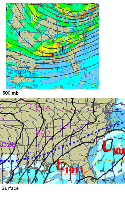
Check out the NAM upper level and surface for midnight tomorrow night.
You can see the big upper level disturbances moving in (top). Notice, however, that the surface low is fairly weak and spread out from NW FL to South Carolina. One way a surface low enhances snow is through convergent, cyclonic (curved) flow, where friction causes convergence at low levels and lift in the atmosphere. The flow around this low pressure area is not very convergent, except over south Alabama. Normally, with a surface low in that position and deep cold air, we’d get more than 1″ of snow in BHM. But, the surface flow is weak, so most of the snow could be driven by the upper-level dynamics. It’s a little too early to tell, but model forecasts for snow in BHM range from 0.5″-1″ on some, to more than 2″ on the snowiest one. Consensus here would say 1-2″ in BHM.
Now, farther south, the flow is a little more convergent, and there is typically more moisture. But, temperatures will start out in the mid to upper 40s, so a lot of snow will have to fall before any accumulation occurs. Places like Clanton, Demopolis, and Sylacuaga may see more snow than BHM or even HSV, but most of it won’t stick.
Category: Winter Weather


