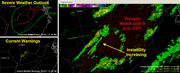
Tornado Watch Issued for Ohio Valley
Here is a quick look at the severe weather to the north of Alabama early this afternoon.
The NWS Indianapolis is busy issuing severe thunderstorm warnings right now, but no severe weather reports received yet.
No changes in the forecast for us. Showers and storms will form over the Tennessee Valley of North Alabama around 4-5 p.m. this afternoon. A few showers will break out as far south as I-20 between 5 and 7, but they will be spotty and not heavy. Some heavier storms will reach into Tennessee Valley Counties of Alabama around 6 o’clock or so, continuing until around 11 p.m. or so. That will be the short window for severe weather for places from Huntsville over to Scottsboro.
The spotty showers and storms will continue pushing southeastward through the evening hours, and we will see a couple of storms over Central Alabama between 7 p.m. and midnight. One or two of them could be heavy, but severe weather is not expected.
Category: Alabama's Weather


