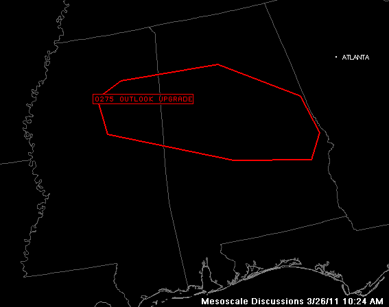
Going Moderate
From the SPC…
ACUS11 KWNS 261521
SWOMCD
SPC MCD 261521
ALZ000-MSZ000-261615-
MESOSCALE DISCUSSION 0275
NWS STORM PREDICTION CENTER NORMAN OK
1021 AM CDT SAT MAR 26 2011
AREAS AFFECTED…NE MS…CNTRL/NRN AL
CONCERNING…OUTLOOK UPGRADE
VALID 261521Z – 261615Z
1630 UTC DAY 1 CONVECTIVE OUTLOOK WILL BE UPGRADING PARTS OF NE MS
AND CNTRL/NRN AL TO A MODERATE RISK. CATEGORICAL RISK WILL BE
DRIVEN BY 15 PERCENT TORNADO PROBABILITIES. REFER TO GRAPHIC FOR
DETAILED AREA.
DETAILS WILL BE FORTHCOMING IN SWODY1 BY 1630 UTC.
..RACY/HALES.. 03/26/2011
Category: Alabama's Weather, Severe Weather


