Cold thunderstorms, gravity wave
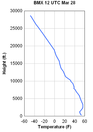
Last night was a rare setup across Alabama, with a shallow layer of cold, stable air near the surface, and warm, unstable air above the surface. Take a look at the ballon data from Calera from last night at 7 pm.
Notice how the air is cold and stable near the ground, with an inversion (temperatures increasing with height) below 3000 feet. For thunderstorms, the air needs to be unstable (temperature decreasing rapidly with height). That’s what happens above 6,000 feet. The temperature decreases 80 degrees F over 20,000 feet, or about 4 degrees per 1,000 feet, aloft. This is quite unstable, allowing thunderstorms to form above the ground. You don’t typically get much wind from these, but a lot of lightning, and with the cold air aloft we had hail reports.
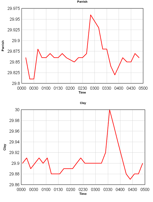
The other neat thing is that the environment above supports gravity waves very well. Stable air for them to propagate in near the surface, unstable air aloft to reflect them back down and keep them going. A wave moved across central Alabama last night between 10 and 11 pm, forming a band of showers along its ridge, and producing rapid pressure rises then falls, and an associated wind gust due to the pressure change. Below are plots of pressure from Parrish and Clay.
Times are in UTC (so subtract 5 hours for our time). Winds gusted up to 25-35 mph with this feature. The peak of the wave came across Parrish around 945 pm and Clay around 1035 pm.
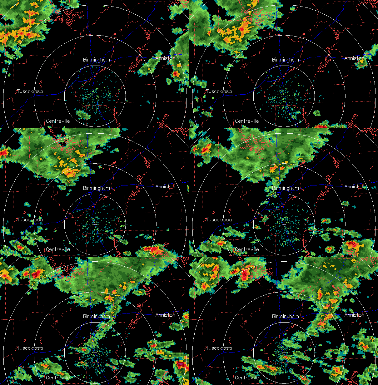
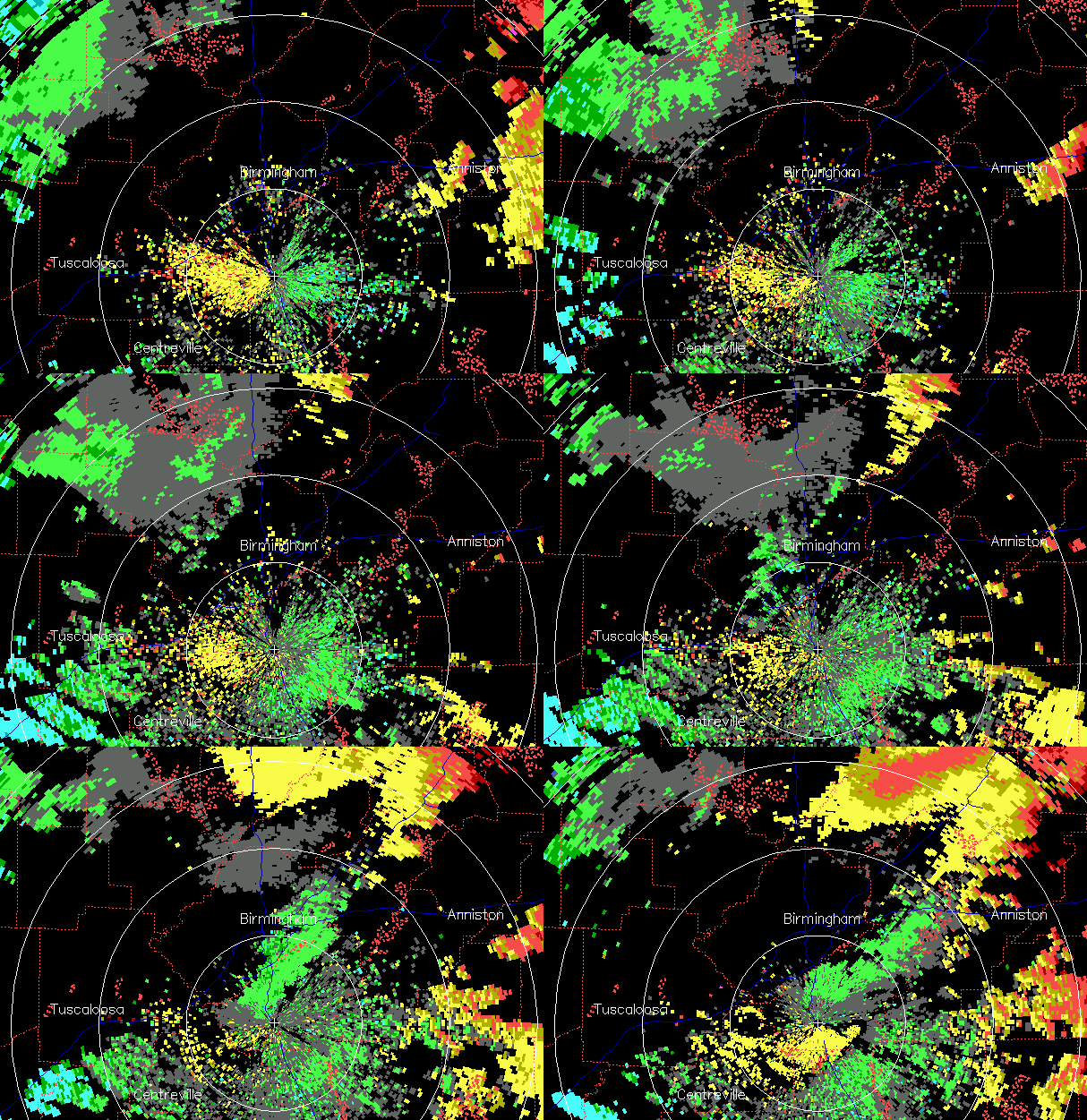
Here are radar loops from the wave event. The upward motion with the wave produced a line of showers.
Reflectivity (rainfall)
Velocity (green away from radar, yellow toward)
Notice too how the strongest winds don’t show up until the wave gets near the radar. This is because the strongest winds in a gravity wave are near the ground.
Category: Met 101/Weather History


