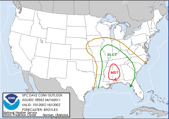
Moderate Risk for Tomorrow
The Storm Prediction Center’s 1 AM Convective Outlook update placed most of central and western Alabama as well as eastern Mississippi in a *MODERATE* Risk of severe weather tomorrow. The most eye-catching statement in their discussion is this statement:
…TORNADO OUTBREAK BECOMING INCREASINGLY POSSIBLE ACROSS THE CNTRL
GULF COAST STATES ON FRIDAY INTO FRIDAY NIGHT…
This is a different animal than the moderate risk from Monday. The risk categories are assigned based on either the number of severe weather reports or the severity of the damage (such as expecting long-track, damaging tornadoes). Tomorrow’s event will bring all types of severe weather to the table: damaging winds, hail, and tornadoes. As far as timing goes, we expect the greatest threat to materialize in the late afternoon over eastern Mississippi; those storms will rumble over Alabama from around sunset on through the evening.
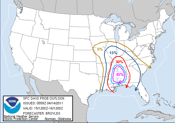
Below is the probabilistic outlook for tomorrow’s event. I won’t take the time to explain it all here, but if you’re interested in understanding more about the probability forecast, you can see it at SPC’s info page.
-Jason
Follow me on Twitter: @simpson3340
Category: Severe Weather


