Severe Thunderstorm Watch to Our West
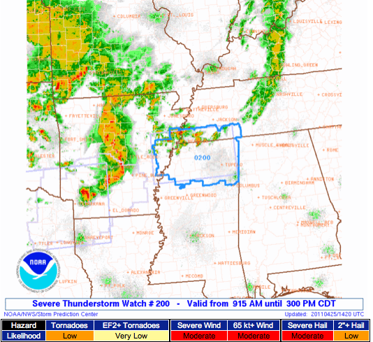
The Storm Prediction Center has placed north Mississippi, eastern Arkansas, and southwestern Tennessee under a Severe Thunderstorm Watch until 3 PM today. A line of thunderstorms capable of producing damaging winds and hail is moving through central Arkansas this morning, and it may bring some rough weather to the watch area soon. The “bowing” segment in the image below just south of Little Rock is traveling east-northeast at about 45 to 50 MPH. That means, if these storms can maintain their intensity, they will move into northwest Alabama (Hamilton, Florence, and Russellville) around 2:00 to 3:00.
The dynamics may not be strong enough this far east for the storms to maintain much strength as they pass over the border into northwestern Alabama; however, it is possible that enough instability is present for a few strong or severe storms could make it into that northwest corner of the state through this evening.
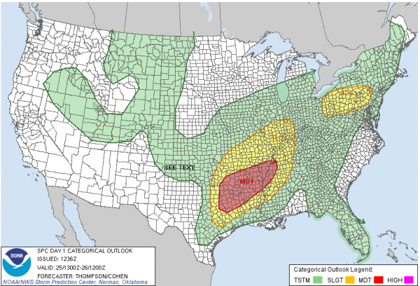
SPC has the northwest corner of Alabama in their SLIGHT risk for today; remember that the threat of severe weather is a little greater tomorrow, and then it peaks on Wednesday.
-Jason
Follow me on Twitter: @simpson3340
Friend me on Facebook: Jason Michael Simpson
Category: Severe Weather


