Watching A Drought Grow
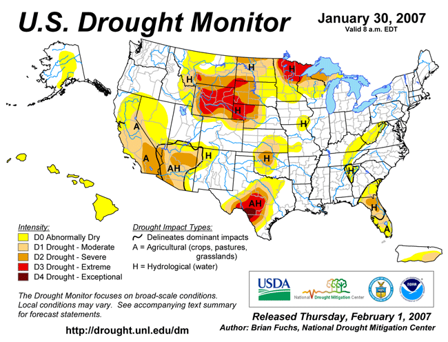
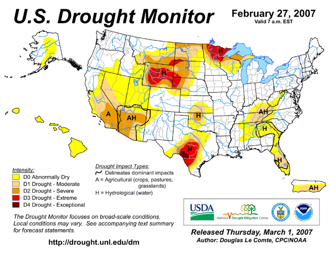
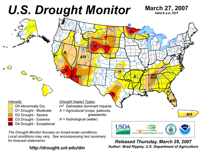
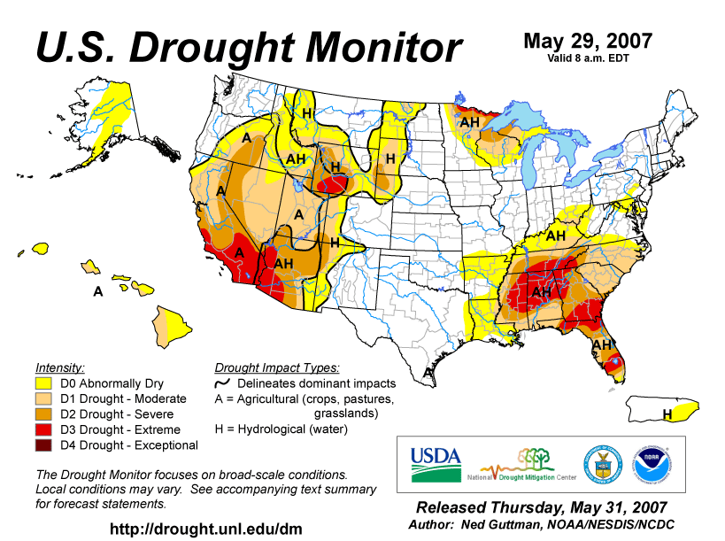
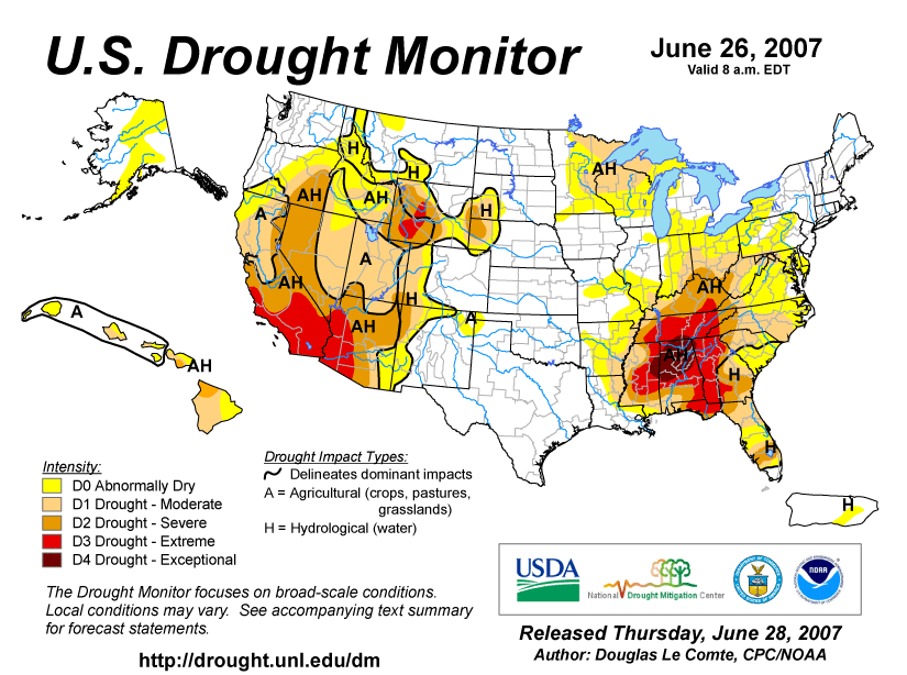
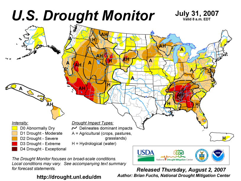
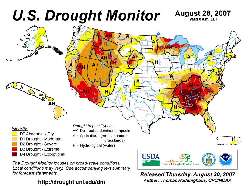
A drought of historical proportions began gripping the Southeast U.S. in 2007, and despite some small relief in recent weeks from light rains, rainfall deficits continue to grow in many areas. In January, abnormally dry conditions were limited to the area from the Smokies down into western Georgia. That had expanded across the northern half of Alabama by the end of February. By the end of March, moderate to severe drought covered much of eastern Tennessee and Alabama. Through April and May, the drought area grew until it covered much of the Southeast. In June, things got worse, as exceptional drought conditions centered on Alabama. Some gains were made in July, but by the end of August, exception drought conditions covered southern Tennessee, much of Alabama, northern Georgia and southwestern North Carolina. The area of exceptional drought has actually expanded through October and November with little relief so far in December. The latest seasonal outlook through March indicates that the drought will persist.
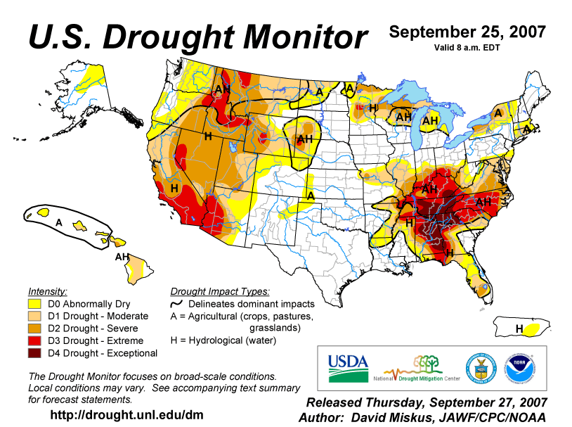
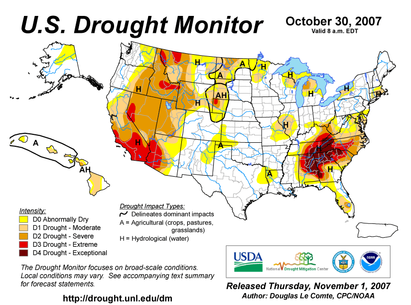
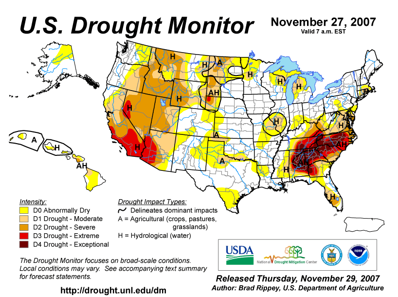
I went back and looked at the Drought Monitor maps for each month in 2007. In these graphics, you can see the anatomy of a historic drought growing in Alabama and the Southeast.
January
February
March
April
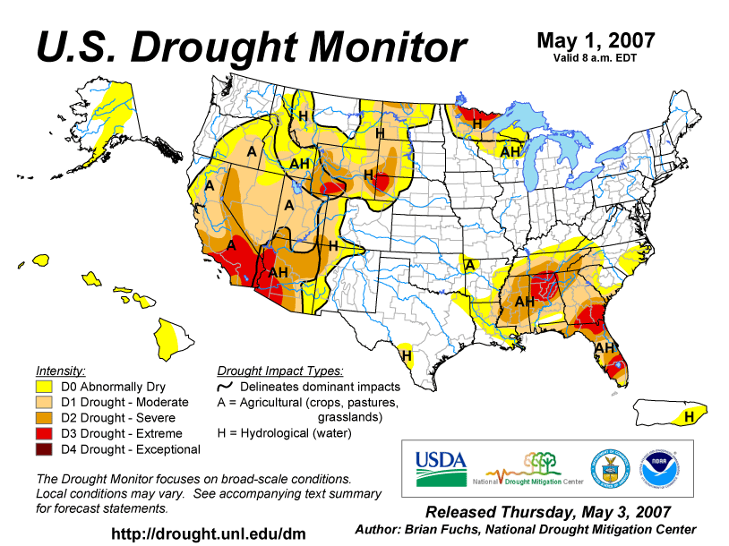
May
June
July
August
September
October
November
Category: Uncategorized
About the Author (Author Profile)
Bill Murray is the President of The Weather Factory. He is the site's official weather historian and a weekend forecaster. He also anchors the site's severe weather coverage. Bill Murray is the proud holder of National Weather Association Digital Seal #0001 @wxhistorianSubscribe
If you enjoyed this article, subscribe to receive more just like it.


