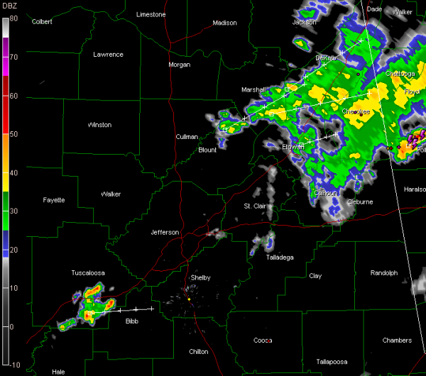
Alabama at 7:15 p.m.
A cold front is approaching Birmingham and Tuscaloosa at this hour. The dewpoint has already fallen to 59F at Columbus MS. At Memphis, it is 55F.
Showers with some embedded thunder is located over Northeast Alabama, from Anniston to Guntersville to Fort Payne. The rain is light to moderate. About the only lightning I can find is over Cherokee County.
A single lone thunderstorm was passing south of Tuscaloosa, pushing ENE toward northern Bibb and Shelby Counties.
The axis of an upper level trough is lined up along the western border of Alabama. The cold air aloft associated with the center of the trough is making for about 1,000 j/kg of CAPE over western Alabama. The instability could trigger a few more thunderstorms overnight, but they won’t be strong.
A brief period of clearing may rotate into the state overnight, but skies will become cloudy again Friday morning. It will take awhile for those clouds to erode. Overnight lows will drop to near 60F on average. Highs will be in the middle 80s tomorrow afternoon, if the clouds break and allow enough sunshine.
There could be a shower or storm in the leftover instability tomorrow but there won’t be any problems.
The weekend will be partly cloudy and warm, with highs around 90F.
Category: Alabama's Weather, Severe Weather


