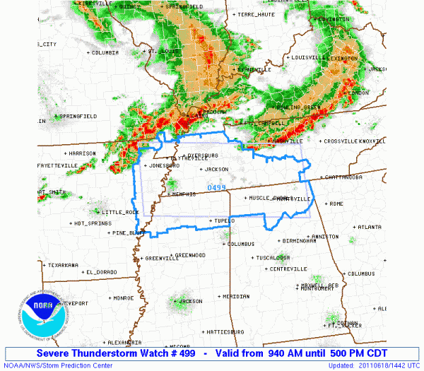
Severe Thunderstorm Watch for the Tennessee Valley of North Alabama
The SPC has issued a severe thunderstorm watch for parts of North Alabama. It goes until 5 p.m. CDT.
It is for the storms that are now over southern Missouri and northeastern Arkansas, as well as others in the Nashville area that are dropping southeastward.
The western storms are expected to push southeastward across western Tennessee and into northern Mississippi around 1 p.m. and Northwest Alabama about 2:30 p.m.
The eastern storms will clip Northeast Alabama around 1-2 p.m.
For West Central Alabama, the storms could reach you around 3 p.m., and possibly into the Birmingham area by late afternoon.
There is a good bit of instability and decent speed shear, meaning storms will be strong and organized. Temperatures in the mid levels of the atmosphere decrease quickly with height, meaning that once the cap is broken, storms will quickly intensify. They will have the potential for damaging winds and hail. Widespread severe weather is not expected and there is almost no threat of tornadoes.
Alabama counties include: Colbert, Cullman, DeKalb, Franklin, Jackson, Lauderdale, Lawrence, Limestone, Madison, Marshall, Morgan [AL] till 5:00 PM CDT
Category: Severe Weather


