The Ring of Fire
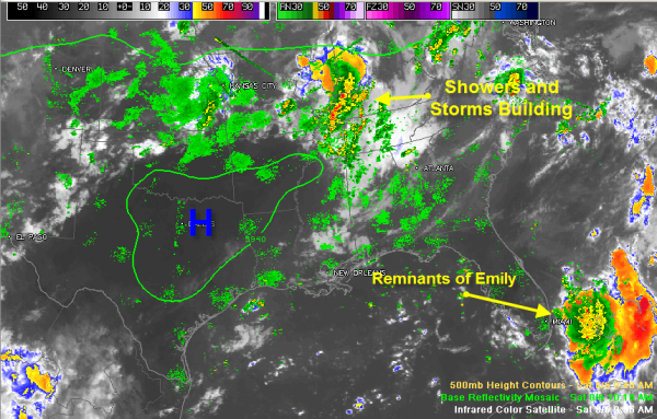
Weather maps this morning clearly show the proverbial “ring of fire” around the upper level high pressure system to the west of Alabama. Luckily, we are under the “fire” part, which means showers and storms will stay in the forecast for Alabama today.
You can see them massing to our north on the composite satellite/radar image. They will swing south in the upper flow around the high pressure system and affect North and Central Alabama this afternoon. Be alert for heavy rain, sharp lightning and strong gusty winds from stronger storms. Hopefully, some decent rainfall amounts will materialize.
Temperatures are warming quickly across central Alabama where there is a decent supply of sunshine. Clouds are more plentiful to the north and south. It was already 88F at Birmingham. As temperatures continue to warm, instability levels will rise, which will feed the storms on their southward march.
To the southeast, we continue to monitor the remnants of Tropical Storm Emily over the Bahamas. The system is becoming better organized and could reorganize into a tropical depression later today. Air Force reconnaissance will investigate the system shortly.
Category: Alabama's Weather, Tropical


