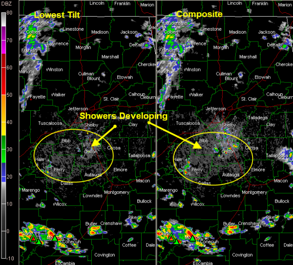
Storms Starting to Grow
Looking at visible satellite imagery this afternoon, clouds are still fairly thick over the northern third of Alabama. An area of clearing has developed along and just south of I-20. Here, differential heating is allowing showers to crank up.
Looking at the data from the lowest tilt of the radar, you don’t see much reaching the ground. But using the composite data, which sums all the returns from the various tilts, you can see precipitation that is being held aloft by building updrafts that is not reaching the ground. These echoes are incipient thunderstorms that will be going strong soon.
They extend from Perry through Chilton and Coosa Counties. Hopefully others will develop through the afternoon hours. Be alert for lightning, however.
The ring of fire seems to be setting up near the Georgia border, where storms are occurring from Chambers through Lee, Russell and Barbour Counties.
Lighter showers are over Northwest Alabama from Lamar through Fayette, Marion and Franklin Counties into Colbert and Lauderdale Counties.
Category: Alabama's Weather


