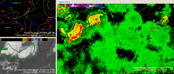
Overnight Outlook
A couple of thunderstorm complexes are to our northwest tonight. The western Tennessee system is about 4-5 hours from Northwest Alabama. It is not as strong as the Arkansas system, which is accompanied by several severe thunderstorm warnings. The Arkansas system could reach West Alabama in about 8-9 hours. That is if they hold together.
So Northwest Alabama could see storms during the predawn hours and West Alabama by early morning. They should slowly go downhill overnight. In any case, they will at least provide boundaries for convection to focus on tomorrow during the late morning and afternoon.
Overnight lows will drop to near 70F.
We should see the peak of the Perseids Meteor Shower early Saturday morning. You could see 20 meteors per hour in the predawn hours. That is if the southeastward bound storm complexes don’t turn your location cloudy.
Showers and storms will develop ahead of a southeastward moving cold front that will reach Central Alabama by Sunday morning. They will be most likely late Saturday afternoon and Saturday night. Some of them could be strong to severe. Damaging winds will be the biggest threat.
Saturday highs will be in the middle 90s unless clouds and showers early in the day are able to slow the temperature rise.
Category: Alabama's Weather


