Late Look At Irene
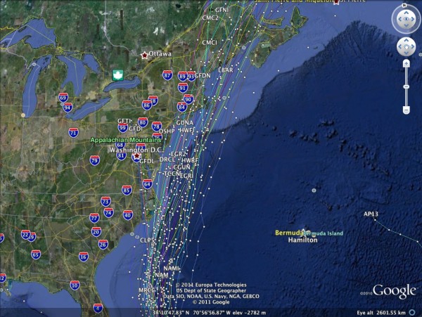
Below is a look at the 00Z model set on Hurricane Irene…
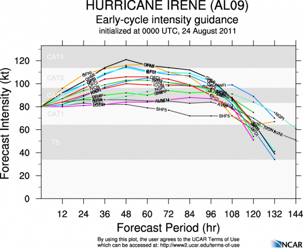
And, the intensity forecast….
Looks like Irene will pass near, or just east of the North Carolina Outer Banks Saturday night, perhaps as a category three hurricane. Then, it heads for Cape Cod Monday as a weakening Category One hurricane.
All of this, needless to say, is subject to change. But, our friends in Florida, Georgia, and South Carolina are certainly breathing much easier tonight with this track well to the east of the coast of those three states.
Category: Tropical


