Major flood threat, possible tornadoes, over next 24 hours
…FLASH FLOOD WATCHES AND WARNINGS…
…TORNADO WATCH…
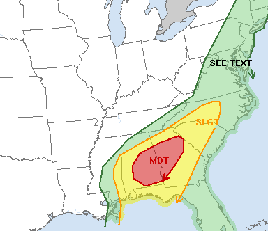
…MODERATE RISK FOR SEVERE WEATHER…
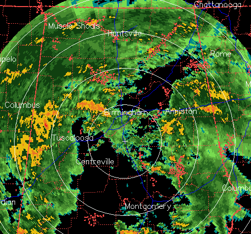
Very heavy tropical rain, with embedded thunderstorms, continues over much of Alabama this morning. Some rainfall totals since 8 am yesterday include 1.4″ BHM, 3.91″ Jasper, 2.57″ Cullman, 1.37″ HSV, 4.25″ MSL.
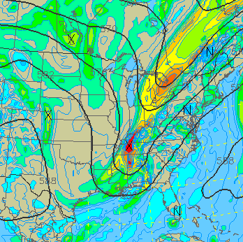
Lee is now a tropical depression, but the center is south of Jackson, MS, moving toward Meridian. It will turn NE and move through Alabama tonight and tomorrow, bringing more heavy rain with it. Another problem is that an upper-level disturbance and cold front will interact with the tropical system later today and tonight, enhancing rain in some areas.
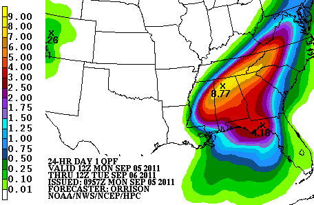
Take a look at the latest NCEP 24-hour rainfall graphic (ending 7 am tomorrow):
This indicates that an additional 5 to 8″ of rain will fall through tomorrow morning over most of north and central Alabama, including TCL, BHM, Cullman, and HSV.
This could cause life-threatening flash floods, first of all. If you approach a water-covered road or bridge, please just take another way home and don’t risk drowning. So many people figure they can make it, don’t, and then it’s often too late.
We will also have to deal with river flooding, potentially along the Tennessee, Black Warrior, Coosa, and Cahaba Rivers. I am here at Warrior River, and the Corps of Engineers did it great job of getting the water down as low as possible by letting it all off downstream before the storm came in. But, eventually, even on flood-controlled rivers like this, it may be hard to contain 5″ of rain or more over a huge area, and rivers may not crest until Wed or so, since it takes a while for the water to flow in through streams, creeks, and springs.
Then there is the tornado threat. With wind shear due to the tropical storm and very humid air, a few short-lived tornadoes may spin up today (see James’ discussion on that below).
Category: Severe Weather, Tropical


