Low along Gulf Coast no TD Lee
A surface low is sitting near Alligator Point, FL this afternoon, and moving slowly westward. It is not really a “tropical” storm, more of a plain low pressure area. But, with high pressure to its north and moisture coming out of the Atlantic and eventually the Gulf, this low is spreading showers and a few thunderstorms into Georgia and parts of south and east Alabama. We may see a few showers tonight and tomorrow over Alabama, and it may also be windy at times through tomorrow (see James’ full forecast below).
But, this system is nothing like Tropical Storm Lee, that came ashore as a weak tropical storm, weakened, then re-intensified over central Alabama on Labor Day, causing widespread downed trees and power lines, wind gusts over 50 mph, and a band of extreme rainfall amounts.
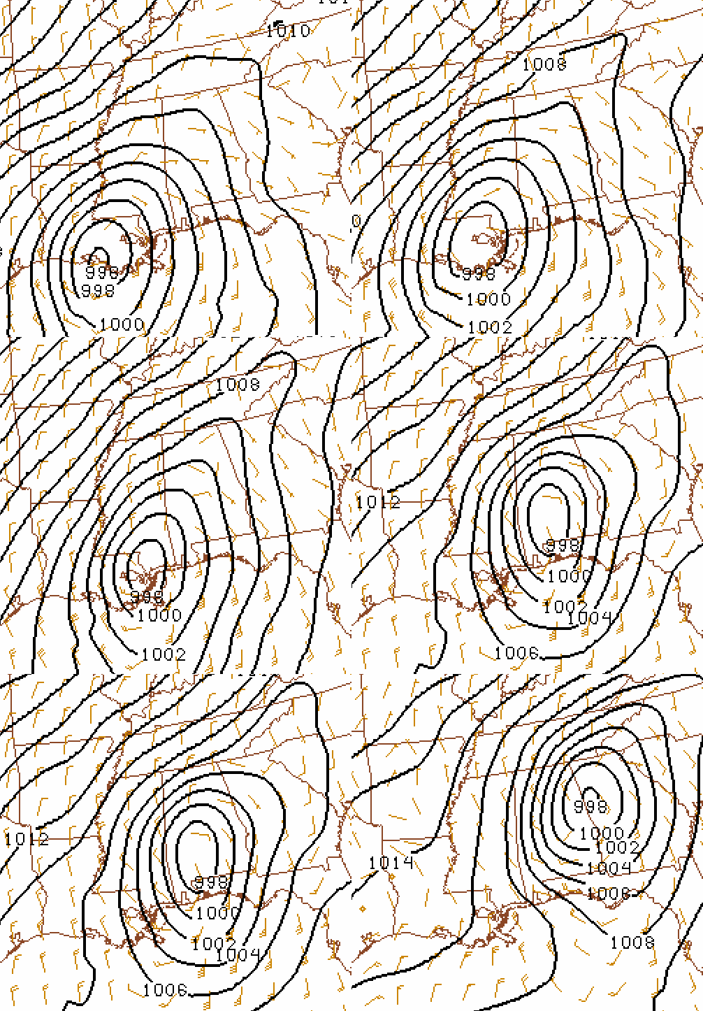
The remnants of Lee interacted with an approaching upper-level disturbance and cold front. I, along with Kevin Laws from the NWS and two colleagues from UAH, Ryan Wade and Kevin Knupp, are evaluating how this re-intensification, strong wind, and heavy rain occurred. Our preliminary conclusion is that upper-level divergence ahead of the disturbance lowered surface pressure, intensifying Lee again near Montgomery, while cold air poured into NW Alabama, raising the pressure there. This created a strong pressure gradient over central Alabama, resulting in the high wind gusts.
Here is a loop of pressure every 2 hours, starting when Lee came ashore:
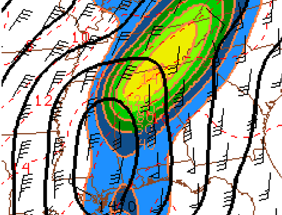
Some of the heavy rain, especially late in the event and over far north Alabama, can be explained by simple over-running of moist warm air over cool air (temperatures were falling into the lower 60s), much like winter-time rain. However, with the cold front moving down and encountering a surge of warm air from the Gulf due to Lee, it caused the front to intensify. A measure of hourly front intensification is shown below, at 11 am CDT Labor Day.
As the atmosphere tried to adjust to the rapid intensification of the cold front caused by Lee, the air to the south of the front rose and cooled, causing copious amounts of rain on the south edge.
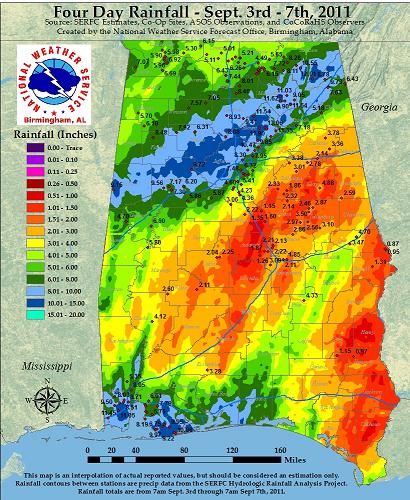
This map, put together by NWS, shows rainfall amounts of 8 to 12″ were widespread from Pickens County all the way to Fort Payne.
We got 9.5″ at Bluff Creek on the Warrior River, and the river rose very rapidly, especially farther upstream from Bankhead Dam at Cordova. The lake temperature went from 84 F on Friday to 72 F on Monday! That’s basically the entire lake being replaced with new water from rainfall.
Category: Tropical


