Snow Early Next Week?
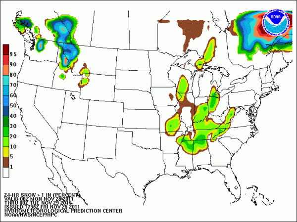
The graphic below suggests a 30-40 percent chance of 1 inch or more of snow in the ground through parts of extreme North Alabama from 6pm Sunday through 6pm Monday CST…
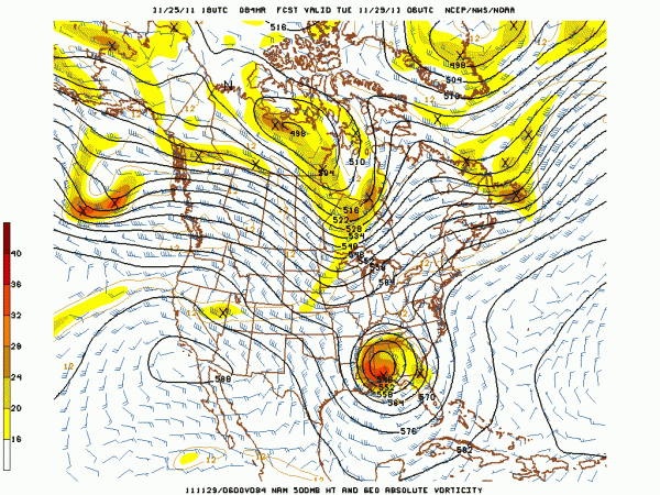
The culprit that will bring the chance of snow flakes is a cold core upper low… here is the 18Z NAM depiction of the upper low at midnight Monday night CST…
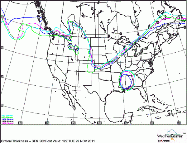
This feature will bring cold and unsettled weather to Alabama Sunday through Tuesday. The graphic below shows the various “critical thickness” values needed for snow (generally speaking)… valid at 6 am CST Tuesday… Note the critical low level thickness values are not in place here (the black line, 1300 meters 1000-850 mb)… meaning much of the snow that falls will melt before reaching the surface.
WOE IS US: You probably have heard the saying “cold core upper low, weatherman’s woe”… these are very challenging to deal with, and almost always bring surprises.
At first glance, the chance of accumulating snow here looks pretty small due to warm soil temperatures and surface temperatures expected to be above freezing. But, ULLs like this can occasionally bring heavier snow showers that can make the ground white in spots. Trying to identify where this will happen now is an exercise in futility.
Best forecast for now is simply to mention cloudy and cold weather Sunday night through Tuesday with a chance of light rain or light snow at times with no significant accumulation expected. Highs only in the 40s… very raw conditions. But, let’s all watch this closely and try to figure out what surprises are on the board for Alabama.
Category: Alabama's Weather


