Snow Potential
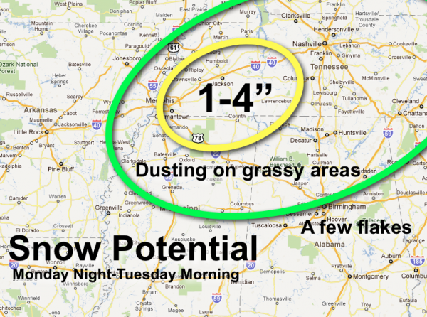
Here is the current thinking on snow accumulation potential for Monday night through Tuesday morning. Seems like the best combination of dynamic cooling and convective snow will be a little east of Memphis, and northwest of Muscle Shoals. Note are suggesting potential of 1 to 4 inches there, but even in that spot most of the accumulation should be on grass, and the roads will remain just wet and slushy. The ground is very warm… and this should not be too disruptive. More of a novelty for late November.
Here in Alabama; just some light accumulation on grass is likely with no travel issues. The main window for snow flakes will come from about midnight tomorrow night through 9:00 a.m. Tuesday.
But remember, there will be surprises with these cold core upper lows. We really won’t know about them until we see radar trends tomorrow night. There might be some here that recall the December 1997 surprise snow over West Alabama with a similar cold core. And, higher terrain tends to get more snow, so we will have to keep an eye on the ridges over Northeast Alabama for possible enhancement.
Category: Alabama's Weather


