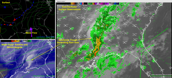
Rain, Some Embedded Thunder, Nothing Strong
Rain was increasing over West Central and Southwest Alabama this morning as a shortwave trough lifts northeast across Central Mississippi.
Light to moderate rain was generally along I-59 from DeKalb County in the Northeast to near Birmingham to near Vance.
Heavier rain was over the interstate over Tuscaloosa, Greene and Sumter Counties, extending up into Pickens County. The heaviest rain in Central Alabama was over northern Hale County east of Moundville, moving toward West Blocton and Centreville. Folks in Bibb County will start seeing some heavy rain in the next thirty minutes to an hour.
You start seeing some lightning in southern Hale County, and more lightning as you go south, where there is a bit of elevated instability.
No strong storms today and for most of Central Alabama, only rain with an outside chance of a little thunder the further south you go. The heaviest rain should be south of areas from Bibb through Shelby into Talladega Counties.
Rainfall amounts should be generally under an inch, although we could see some 1+ inch amounts in northern Hale into Bibb counties and points east northeast from there.
Some strong storms have formed in the past few minutes over eastern Louisiana. The NWS Jackson just issued a severe thunderstorm warning for the parishes just west and southwest of Natchez MS. We don’t expect this activity to cause any problems for us Central Alabama.
Category: Alabama's Weather


