Storms Weakening…But We’re Watching
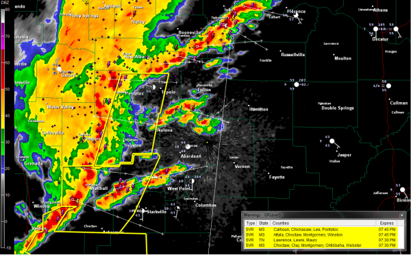
Our complex of storms continues to push rapidly east southeastward across northern Mississippi tonight.
It is now…
…55 miles WNW of Marion and Lamar Counties
…60 miles WNW of Pickens County
…80 miles WNW of northern Sumter County
The complex is slowly weakening. There were a few reports of wind damage from the Delta in western Mississippi, but reports have slowed down considerably in the past hour. Lightning reports are slowly going downhill.
Storms are forming ahead of the main line between Aberdeen and Fulton. Others are west of West Point and Starkville.
To the north, heavy storms extend from north of to the Shoals area of Northwest Alabama.
Severe thunderstorm watch covers northern Mississippi ahead of the line.
All counties ahead of the line roughly from Tupelo to Ackerman are under severe thunderstorm warnings.
All indications are that the line will continue to weaken radpily as it pushes into Alabama. Gusty winds will accompany the storms until they fall apart later tonight.
Category: Alabama's Weather, Severe Weather


