Approaching The Midnight Hour
North Alabama remains quiet as a mouse, while showers have formed to the south…
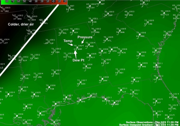
See the surface chart below… the cold front is past Memphis, and around here dew points in the 60s are now as far north as Huntsville…
There is very little surface based instability over North Alabama… so the higher SCP values (supercell composite) are over Southeast Alabama now…
But, the better upper forcing will be to the north, so the whole system is a bit out of phase.
And, the cap still holds. The RPM continues to suggest the cap will break in the midnight to 2 a.m. time frame, with a broken line of strong storms forming over Northwest Alabama…. these will move southeast, and will be capable of producing small hail and strong, gusty winds. The overall tornado threat overnight remains small, but we still can’t completely rule out an isolated tornado somewhere.
The best chance of a severe storm remains along and north of I-20, and generally from 1:00 a.m. until 6:00 a.m.
We will keep an eye on things. Stay tuned…
Category: Alabama's Weather


