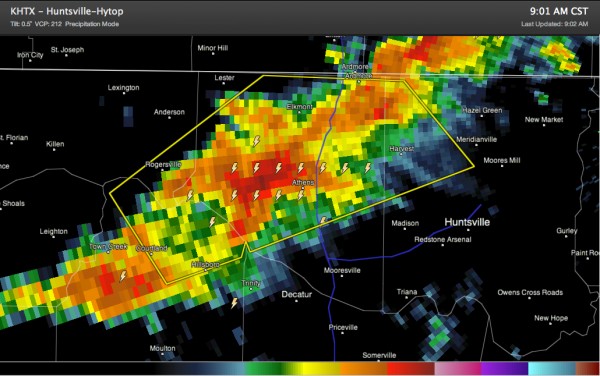
First Alabama Warning of the Day
The NWS in Huntsville has issued a severe thunderstorm warning for Lauderdale, Lawrence, Limestone and Madison Counties in North Alabama.
These thunderstorms have developed in the warm sector that now covers all of Alabama. They are probably being triggered by a weak upper level disturbance passing by in the fast flow just to our northwest.
They will potentially produce damaging winds, hail and even an isolated tornado or two this morning as they continue northeast. The SPC is considering issuing a tornado watch for much of the Tennessee Valley of North Alabama.
Additional storms will be forming and increasing in coverage over Alabama as we head through the morning and especially into the afternoon. The atmosphere over the state will become increasingly unstable and the storms will be strong to severe, increasing in intensity by afternoon. They will continue into the overnight hours, when a strong line of storms will sweep through the state.
Stay here for the latest information through the day. Review your safety plan and know where you will go if warnings are issued.
Category: Alabama's Weather, Severe Weather


