Noon in Alabama–Getting Wetter
That long, long, line of showers and thunderstorms now extends from 80 miles off the Mississippi coast n0rthward parallel to the Mississippi/Alabama border, then into West Tennessee. From there a less active line of showers extends into Iowa and then curves back toward the southwest into Eastern Colorado. The pesky upper-level low-pressure area has a saying that the low is now centered over Oklahoma City.
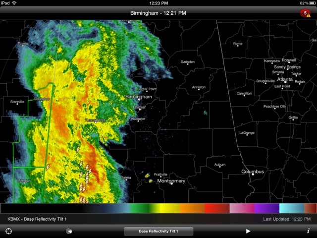
In the lower part of that line, I can tell five separate Flash Flood Warnings now in effect, mainly across Southeast and East Central Mississippi. Extremely heavy rain is also now falling over extreme Southwest Alabama in the Mobile area northward through Mobile County to Clarke County. The National Weather Service in Mobile has issued a Severe Thunderstorm Warning until 12:45 for Central Clarke County and East/Central Washington County. The severe thunderstorm was located 11 miles southeast of Chatham and may be producing wind gusts to 60 mph.
The line of showers and storms will continue to slowly work its way eastward. The greater Birmingham area will be getting wet soon and there could be some moderate to heavy rain at times. However, most of the real heavy rain may stay west of our area.
Category: Alabama's Weather, Severe Weather
About the Author (Author Profile)
Subscribe
If you enjoyed this article, subscribe to receive more just like it.


