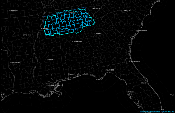
Severe Thunderstorm Watch Issued for North Alabama
Before I even hit publish on my last post, the SPC did issue the severe thunderstorm watch. It goes until 9 p.m.
It includes Colbert, DeKalb, Franklin, Jackson, Lauderdale Lawrence, Limestone, Madison, Marshall and Morgan Counties in North Alabama.
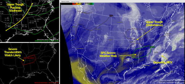
Skies have become sunny in this area and temperatures are soaring toward the 80s. Colder air aloft, associated with an upper trough (disturbance) extending from Indiana to Texas is spreading southeast. Colder air up top, warmer air near the surface yields instability. Instability values are now 1l,000-2,000 joules east of I-65 and 2,000 to 3,5000 joules over Northwest Alabama into northern Mississippi and Tennessee. These values are going from moderate now trending to high, so thunderstorms that form won’t have trouble becoming strong, especially since there is little or no cap.
Storms have fired quickly in the past 45 minutes in Middle Tennessee south of Nashville. These storms and others will spread down into northern Mississippi and northern Alabama this afternoon. There is sufficient change in wind velocity and direction between the low levels and mid levels in the atmosphere, so storms will be able to maintain themselves. The good news is that the low level spin in the atmosphere is very weak, so there is virtually no tornado threat. But there is a decent threat of damaging winds and large hail. Always have to worry about brief heavy rain and dangerous lightning as well.
I think the storms will reach Northwest Alabama by 3 p.m. or so and the Birmingham/Gadsden/Anniston areas around 5-6 p.m. Tuscaloosa may escape but could see storms by 7 p.m. or so. Of course, isolated storms could form just about anytime during the afternoon, since the weather doesn’t stick to our schedules.
So, pay attention to the weather through the afternoon and make sure that you have a reliable source for receiving warnings wherever you are.
Lots of activities going on around the state, including a big race day at the Barber Motorsports Park. But the Internationally Beloved Meteorologist Brian Peters is handling weather duties for Gene Hallman’s team out there, so you are in good hands if you are heading to the track. See Brian’s post right below this one in our blog lineup.
We will have the latest throughout the afternoon right here on the blog.
Category: Alabama's Weather, Severe Weather


