Quick Radar Update
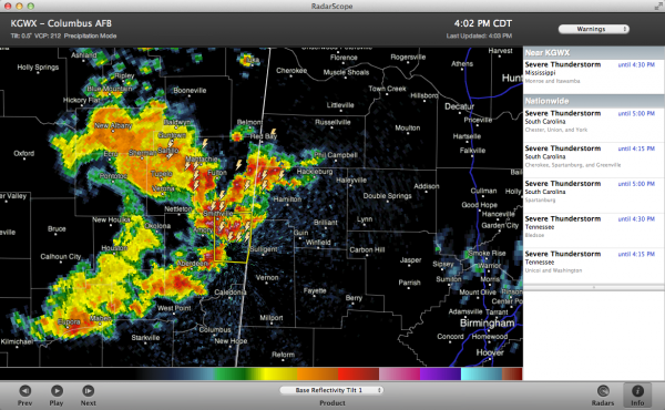
A complex of thunderstorms is moving eastward out of northeastern Mississippi.
Storms have gotten into northwestern Marion County now.
They extend back to near New Albany before they curve down through Smithville, Aberdeen and Amory then on down to near Eupora.
These storms will affect Franklin, Marion, Lamar and Pickens in the next hour. Pickens will be shortly thereafter
A new severe thunderstorm warning was just issued for Monroe and Itawamba Counties in Northeast MS. This storm will reach Detroit and Sulligent before 4:45.
Expect lots of heavy rain, hail and lightning with these storms as well as the potential for damaging winds.
These storms will progress eastward through the afternoon and evening hours.
Category: Alabama's Weather, Severe Weather


